LIDAR leads in McKittrick Canyon
Backpacking into a rare water source in the Guads to check some cave leads found with LIDAR.

Background: LIDAR
The US Geological Survey publishes LIDAR scans of almost the entire United States. These LIDAR scans are taken from planes flying overhead, shooting millions of laser points per second at the ground and precisely timing their return to map ground elevation with high accuracy. A small proportion of laser pulses make it through vegetation on the surface and to the ground, allowing LIDAR to map the true ground elevation, ignoring trees and other vegetation. The USGS publishes 1 meter resolution elevation maps, freely available for anyone to download and use. The 1 meter resolution elevation maps are an astounding achievement of modern technology when you think about it: look around you at any single square meter of space outside, and the USGS knows (and will tell you!) the elevation of that little 1m square to within 50cm.
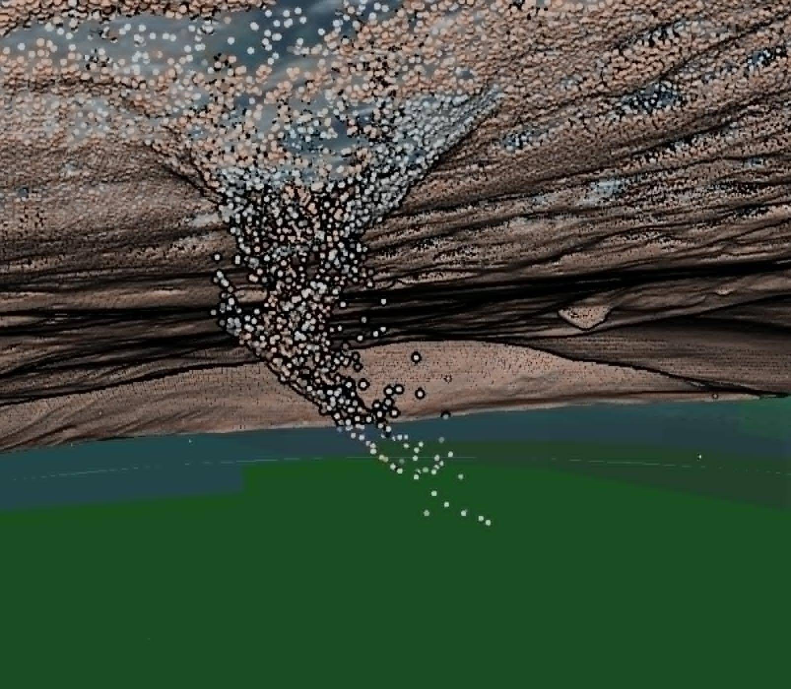
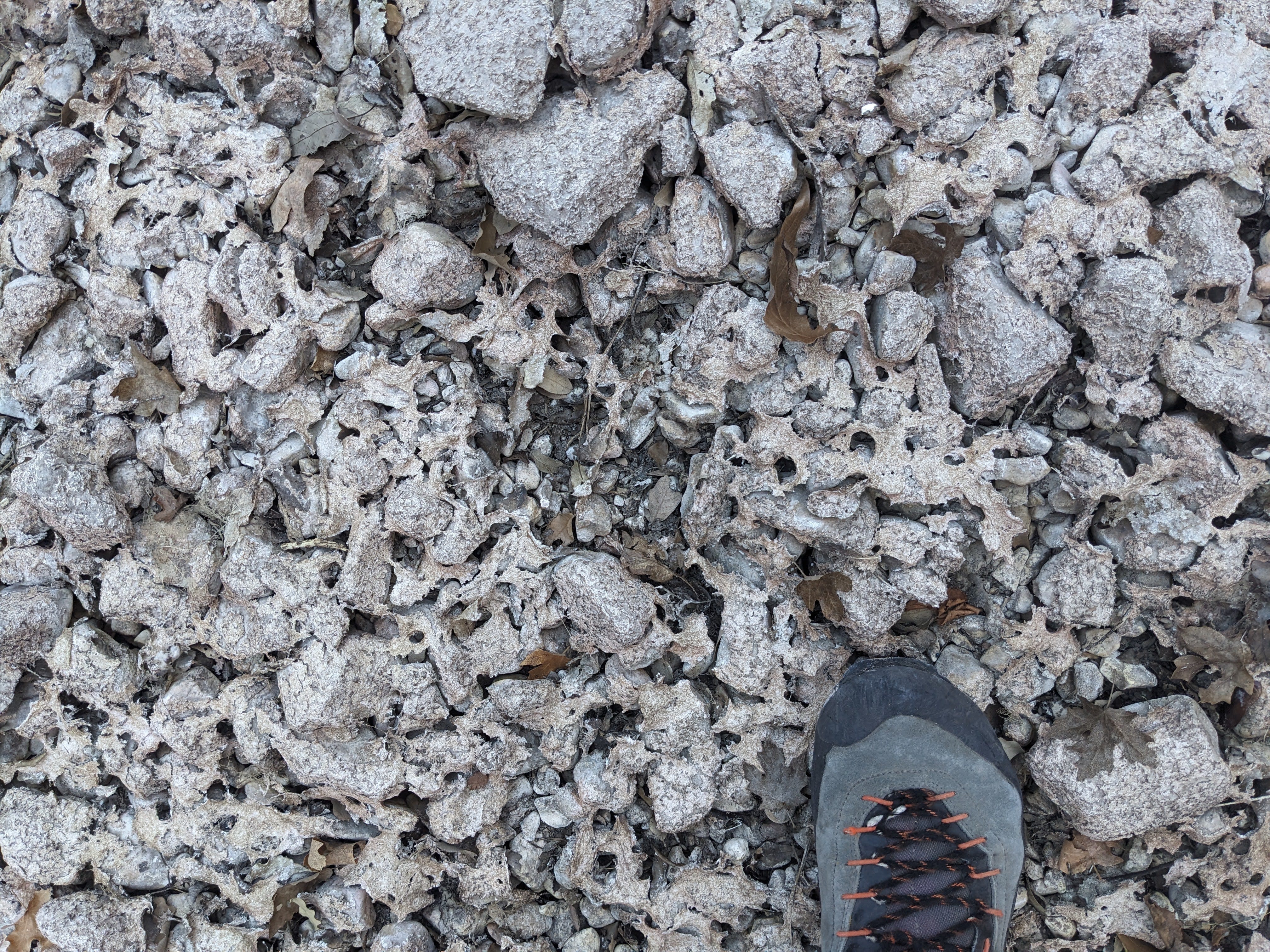
This high-res elevation data is very useful for finding cave entrances. Here’s an example of a small section of point cloud data in the Guads. What do you think this is?
There are several open source tools created by cavers to assist and automate the process of finding potential cave entrances with LIDAR. I created a script that uses depression filling to automatically identify sinkholes in these high-res elevation maps published by the USGS. This script identifies sinkholes and exports them to a list viewable in programs like QGIS and GaiaGPS, and it makes a hillshade map with sinkholes highlighted and color coded by depth for easy identification. The hillshade map looks like this:
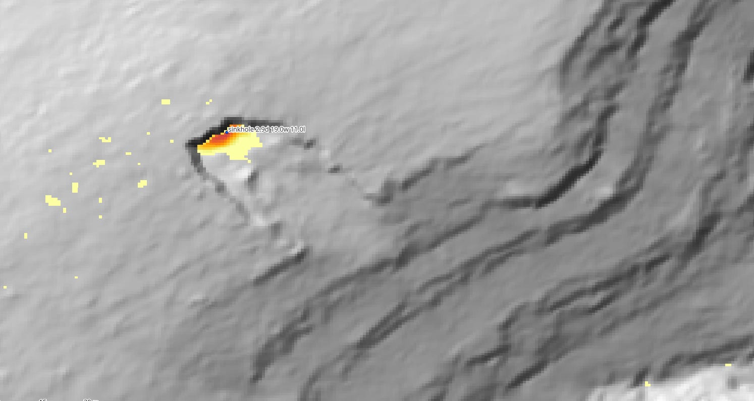
The circle point and text label is for one of the automatically extracted sinkholes. What do you think the above highlighted area is? Do any of the readers of this blog know what that is? Have any of you been here?
Automated LIDAR analysis dramatically increases the efficiency of searching for cave entrances; however, it’s still a very manual process. After sinkholes are automatically identified, I still frequently spend hours poring over the data, judging what are the most promising leads based on LIDAR and satellite data, and planning routes to get to these remote places. And of course the hardest part of finding caves comes after, when you actually have to get yourself to the leads that the computer tells you to go to.
Another useful caver-made program for finding caves with LIDAR is FLEX by Felipe Roz Barscevicius. His program lets you directly view in 3D the raw point clouds from LIDAR, instead of hillshade maps derived from 1m elevation maps derived from the LIDAR. But it’s entirely manual—no automated entrance location identification. Something both of us should do is combine these programs to automatically identify potential cave entrances from raw point cloud data. But both of us are busy, with day jobs and caving and cave-finding to do!
Anyways, enough backstory. A few weekends ago, I checked some LIDAR leads deep in a remote canyon in the Guadalupe Mountains. I had been eying these leads for many months, but only recently got the time to backpack in there and check them out. The canyon, North McKittrick Canyon, is one of the few canyons in the Guads with year-round water, which allowed me to do this as an overnight trip instead of a heroic day trip.
I arrived in the Guads late Friday night, after midnight, after a long day at work. My intent was to enter North McKittrick Canyon from the west side, from below near the end of the Queen’s Highway as it enters Guadalupe Mountains National Park. After arriving there late Friday night, I camped just off the Queen’s Highway, then slept in til the late hour of 9am, when I was awoken by the already blistering hot sun.
Saturday, March 21
I got to my intended parking spot just north of the Guadalupe Mountains National Park boundary and started hiking at the properly alpine time of 10:42am. I carried 6 liters of water, as it was already crazy hot out by mid morning, and I wasn’t sure that the alleged water source in McKittrick Canyon would exist or be flowing, so I brought enough to make it back safely in case there was no water. The heat was telling me that the season for ridgewalking in the Guadalupe Mountains was rapidly coming to an end, but I was determined to get in a few more LIDAR lead checking trips this year.
From where I parked, I went due east, following the park/BLM boundary, until I got to right below the Guadalupe escarpment. Right below the escarpment, I started traversing north to work my way up the many cliff bands guarding the ridge top. Interestingly, I ran into a cairn and a trail here. After a few little scrambles up short cliff bands, I made it to the top of the escarpment. I followed this escarpment due north towards my first LIDAR point.
On my way north, I saw two Barbary sheep just below the ridge about 100 ft away from me. They ran away when we saw each other, so I didn’t get any pictures. Such graceful animals. I thought that this would bode well for the upcoming leads I was to check.
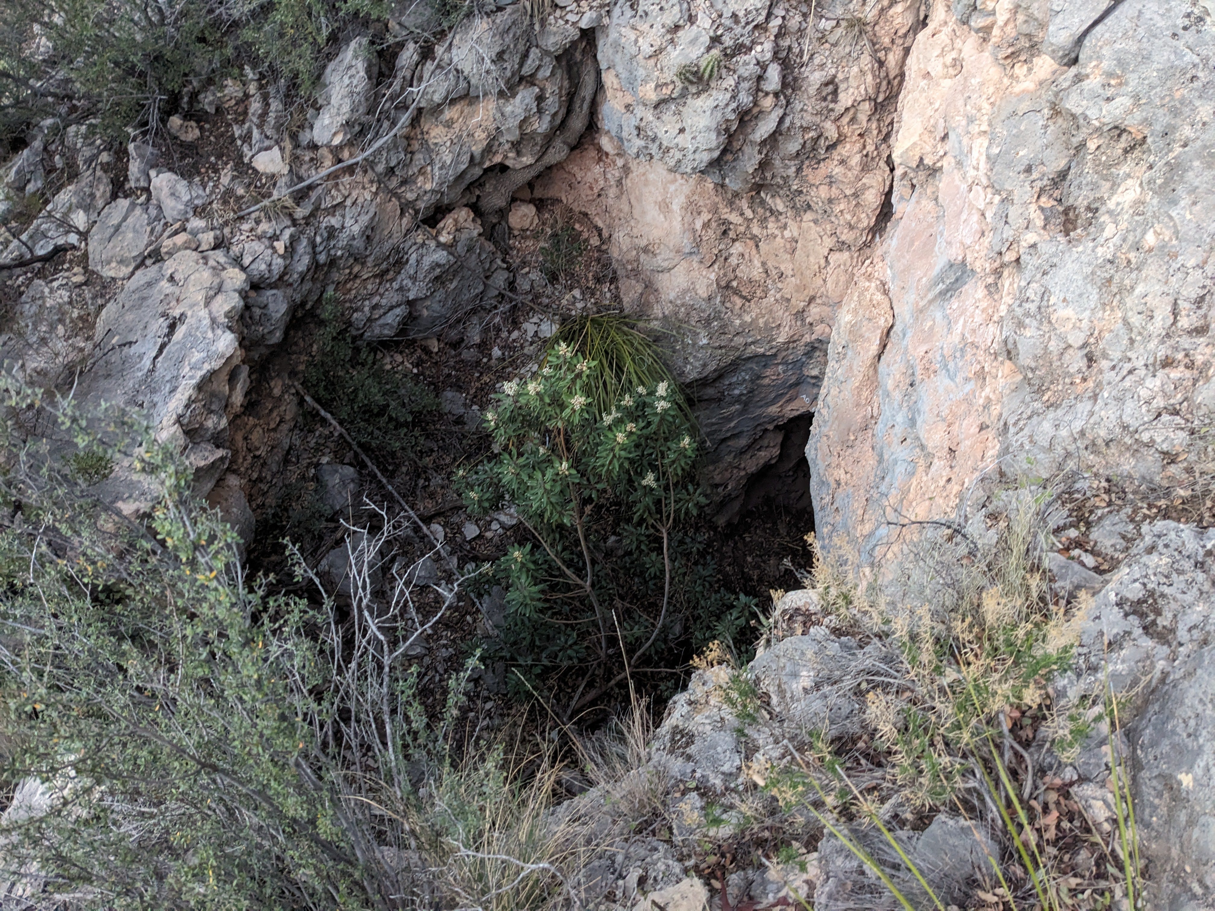
This good luck seemed to pan out, as the first LIDAR hit I checked was in fact a pit. It had a nice rectangular entrance, about 2ft by 5 ft.
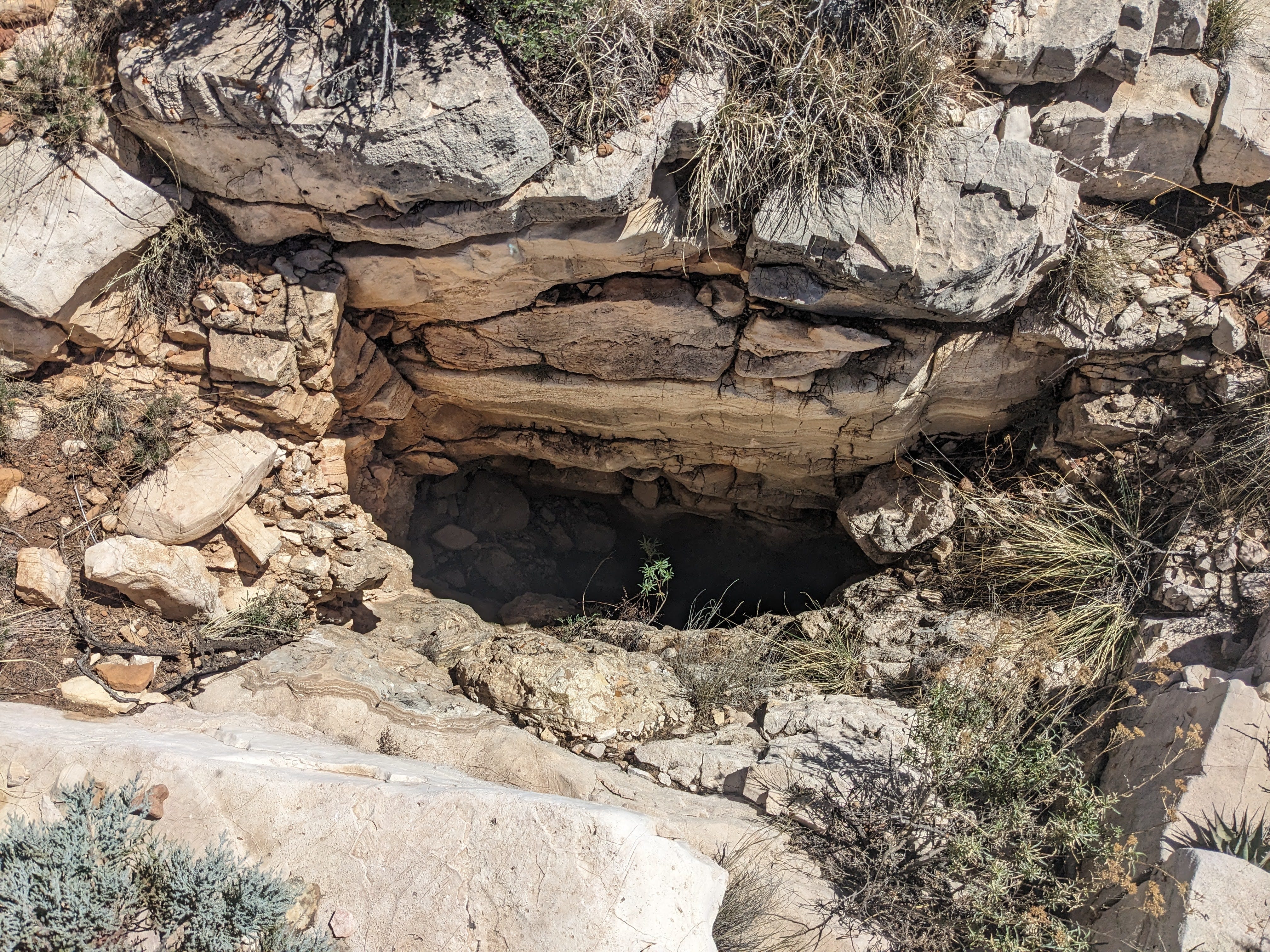
I started downclimbing it and saw a floor beneath me, but it belled out a few ft above the bottom in an interesting rectangular shape. I was pretty sure I could see the entire room at the bottom, but I wasn’t 100% sure. I hemmed and hawed about downclimbing the last bit as it belled out and kept shifting around trying to find a position that would make the last few moves feel secure, until I gave up and decided to rig it. I brought 100ft of ultralight 8mm rope and my ultralight homemade no-buckles harness, so I might as well use it for a climb I was hesitating about. I rigged the pit using a bomber boulder just outside the pit and rappelled in.
I rappelled in and confirmed that it was, in fact, just a blind pit. Oddly, there were 2 Coors beer cans in the bottom. The pit is on a ridge and not somewhere where things would naturally drain into it, so I think these were intentionally thrown in. I did a quick survey and it’s 25 ft deep. I named it ‘Barbary Pit’ after the 2 Barbary sheep I saw on the way there.
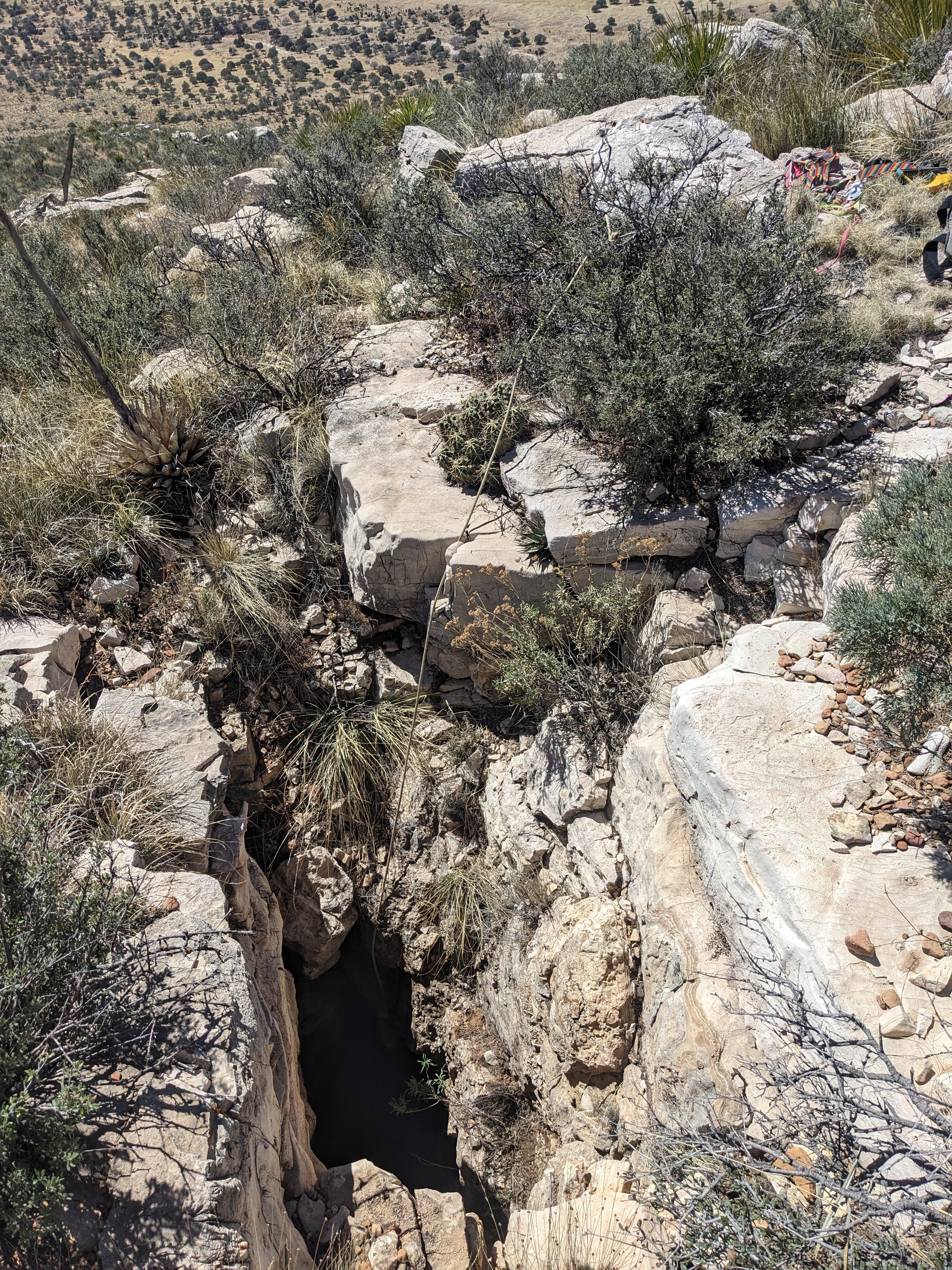
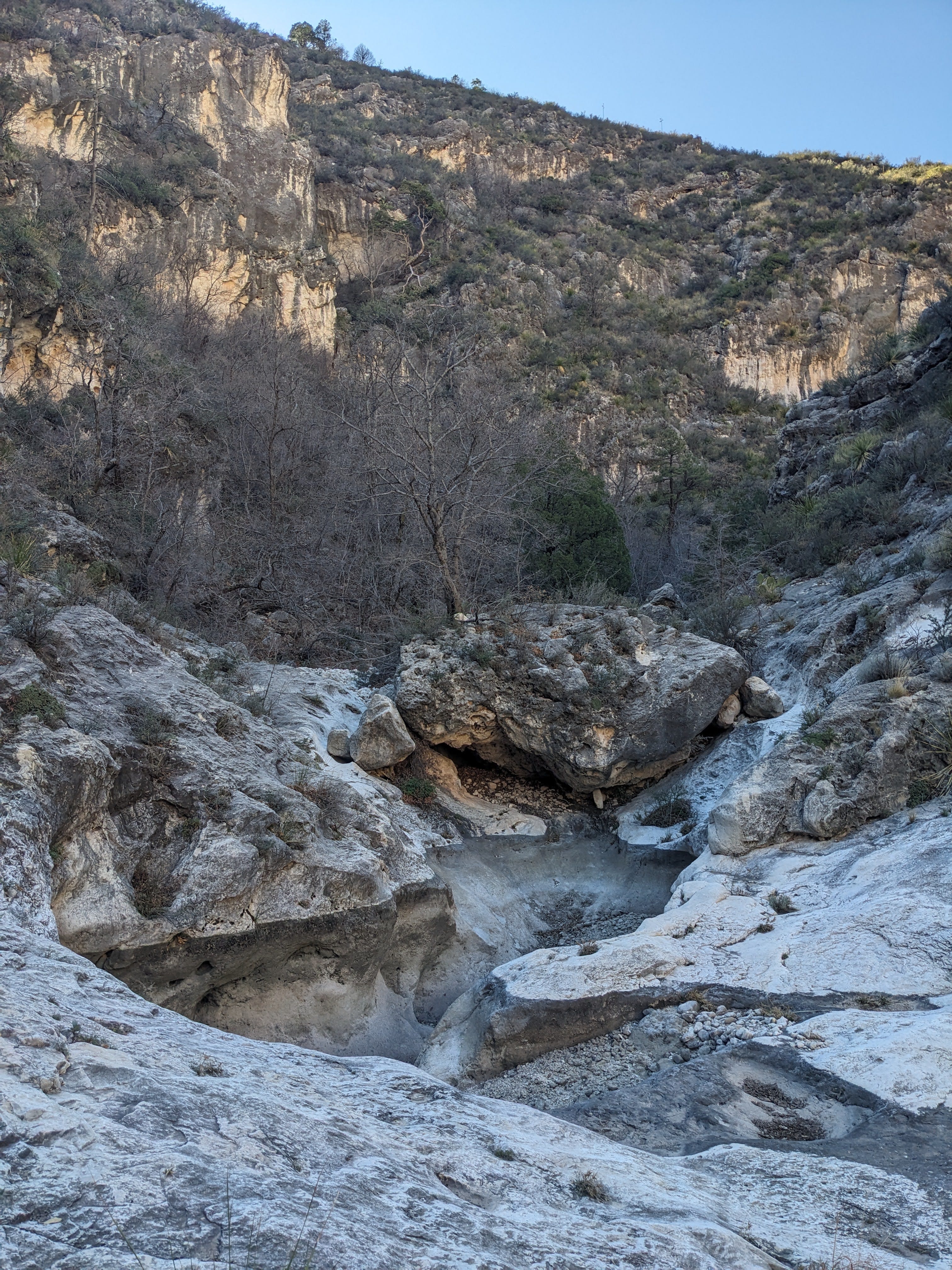
After my quick survey, I descended into the North McKittrick Canyon. I looked forward to getting into the canyon bottom, as there were trees visible there that would provide shade from the hot midday sun. There was allegedly a trail in this canyon that takes you all the way to the Virgin Cave 2WD parking lot, although I was unsurprised to find that this trail totally does not exist. It was unidentifiable when I first got into the canyon bottom, and I did not find it anywhere along the way down the canyon except for one 20 ft section that bypasses a pouroff in the canyon. Whoever traverses this canyon seems to be using the same one spot to get around this pouroff.
I followed the canyon bottom downstream for about 2 miles as it gradually got better and better (wider and less bushwhacky). After those 2 miles I saw my first cliff lead of the day. I spotted one small cliff lead in my entire time in the canyon:
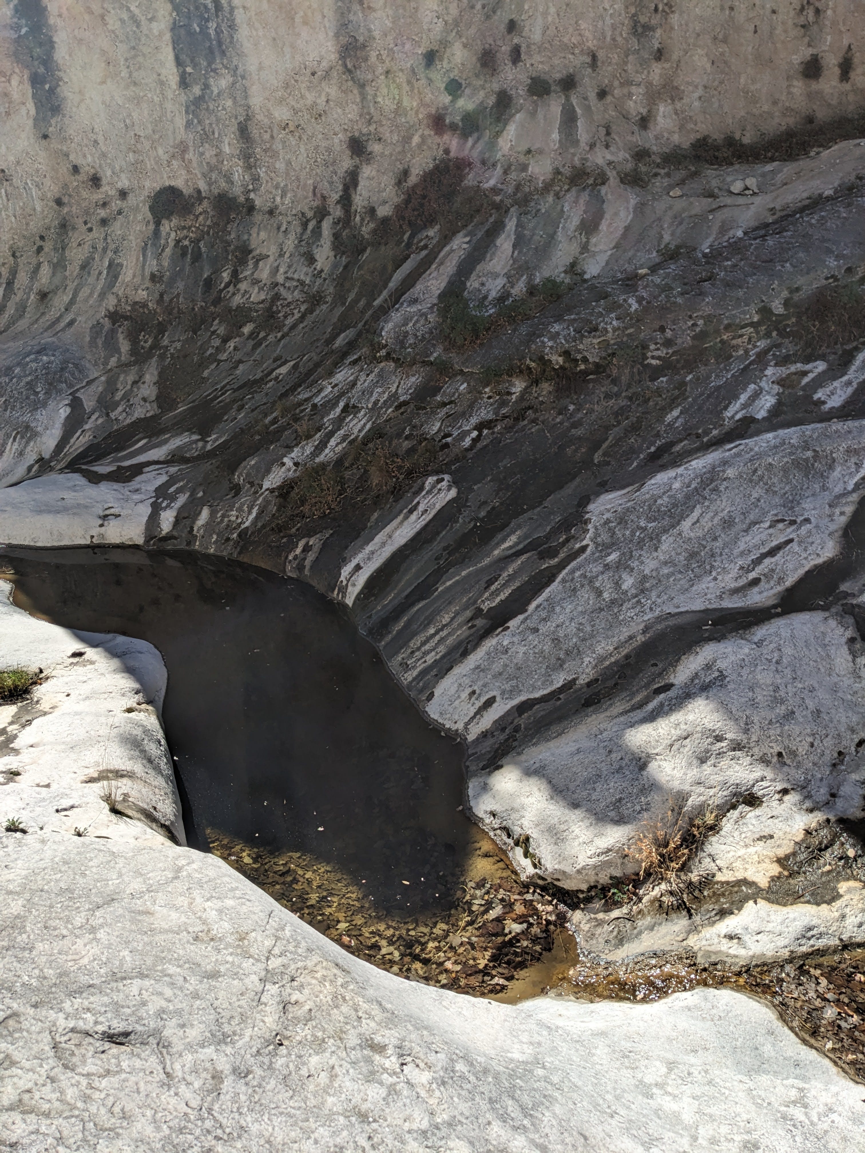
I moved on and continued frolicking down the now-wide-and-flat arroyo. I saw my first water near that cliff lead. This was a gross brown pool that I definitely wouldn’t drink from, but it was a good sign that more water was likely to come.
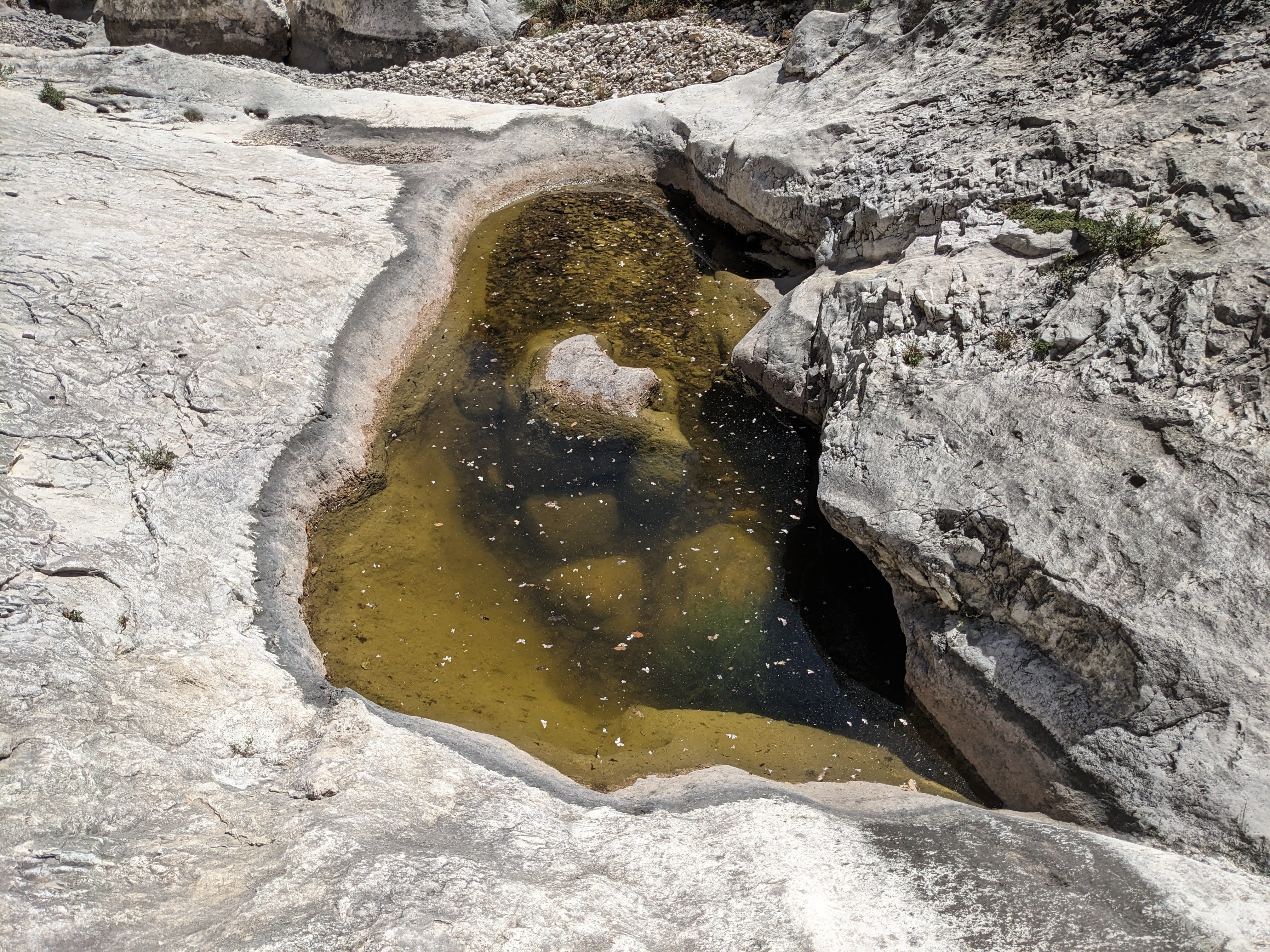
The arroyo eventually turned to bedrock, not gravel, and had many small pools embedded in the bedrock in a row. There were also many micro-springs seeping from the walls creating colorful zebra stripes down the limestone pavement. I saw many sets of these lines of micro-springs all at the same elevation above a pool These lines of springs must represent some sort of water table. Very interesting.
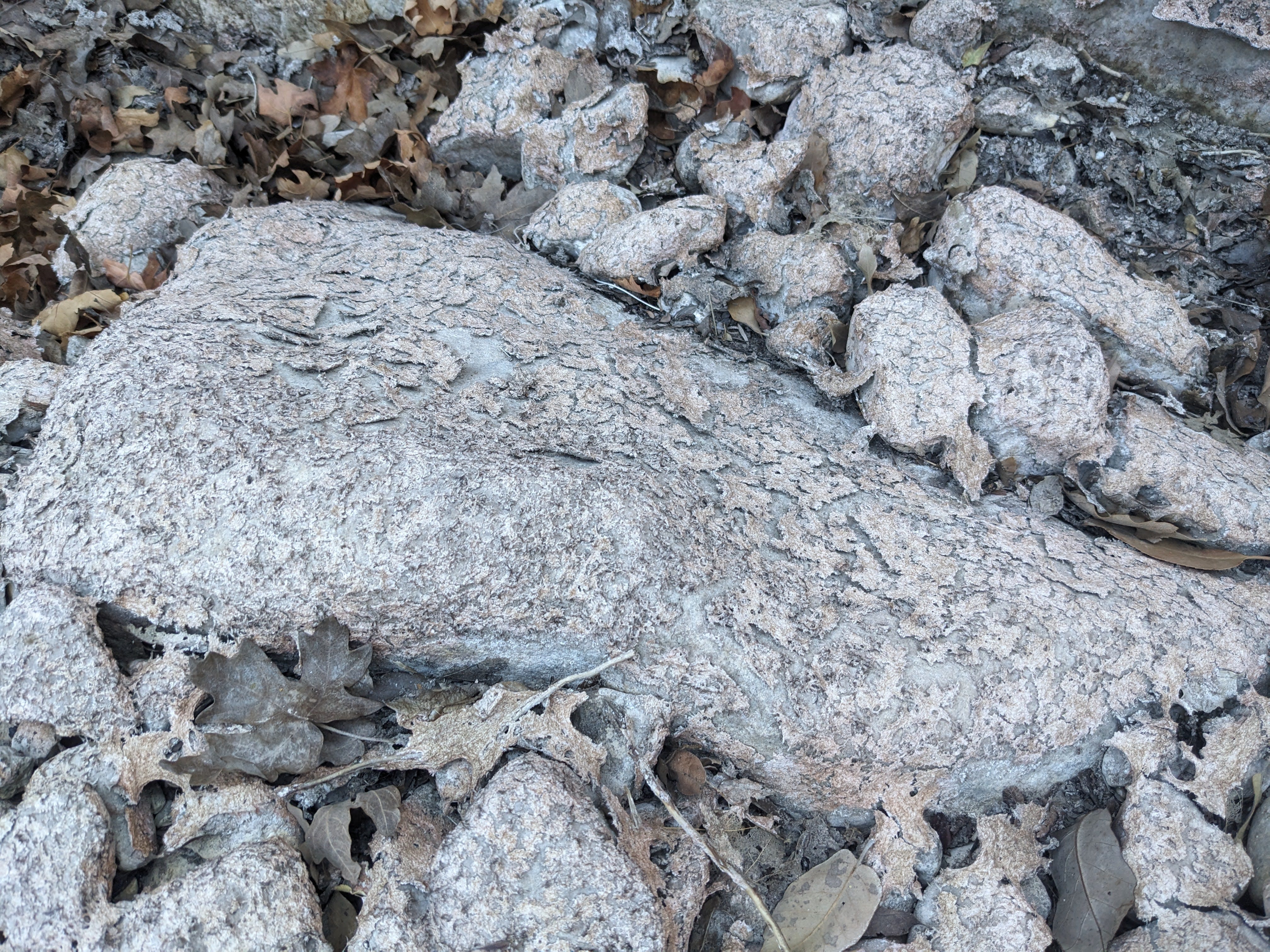
There were also some cool-looking recently dried pools. Some of these had a strange dry film/crust on them. From whatever life was growing in there before the pool dried up?
At 4:30pm, I got to right below the second LIDAR point I intended on checking. I abandoned the comforting embrace of the wide, flat, un-vegetated arroyo for the harsh world of the steep vegetated slope above me. There was a brief scrambly rocky section right as I got out of the arroyo, but after that it was smooth sailing up the bushy slope, at least as smooth as thrashing with an overnight pack can be.
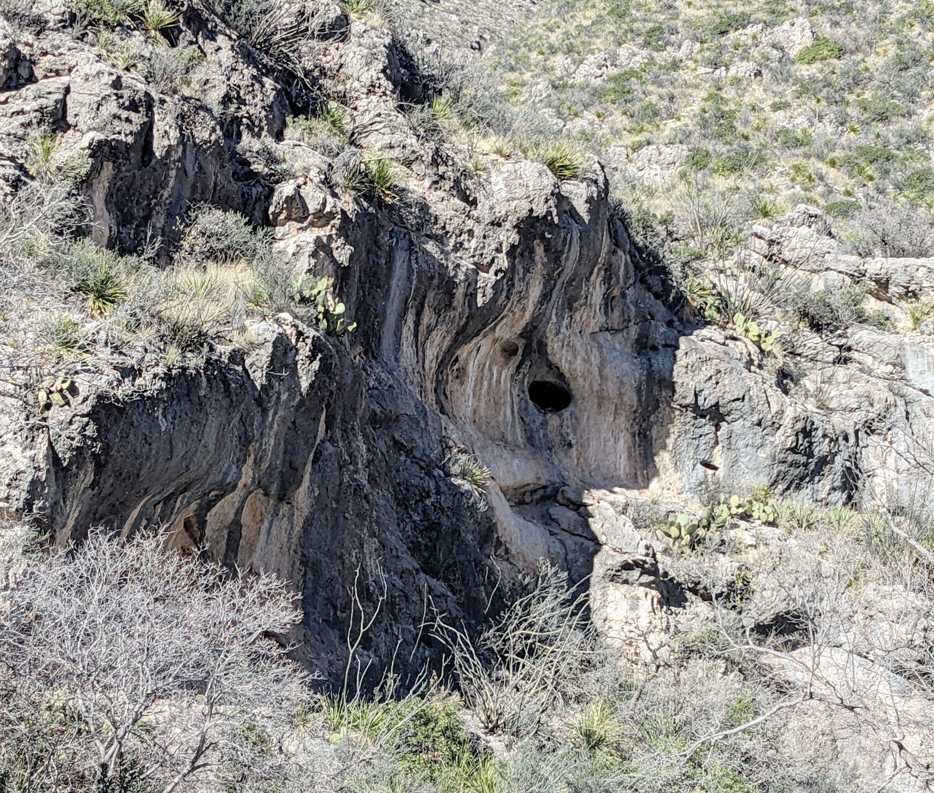
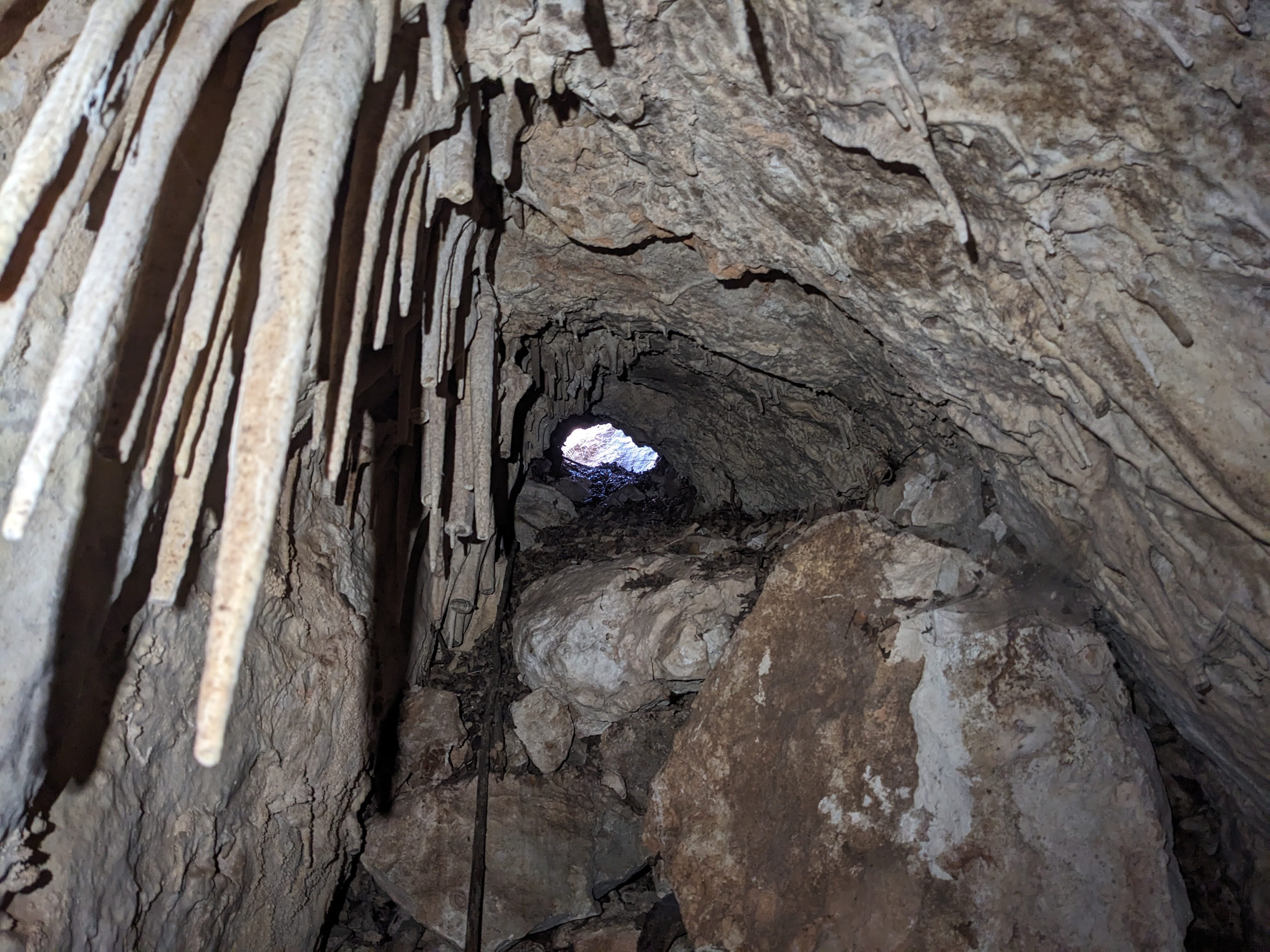
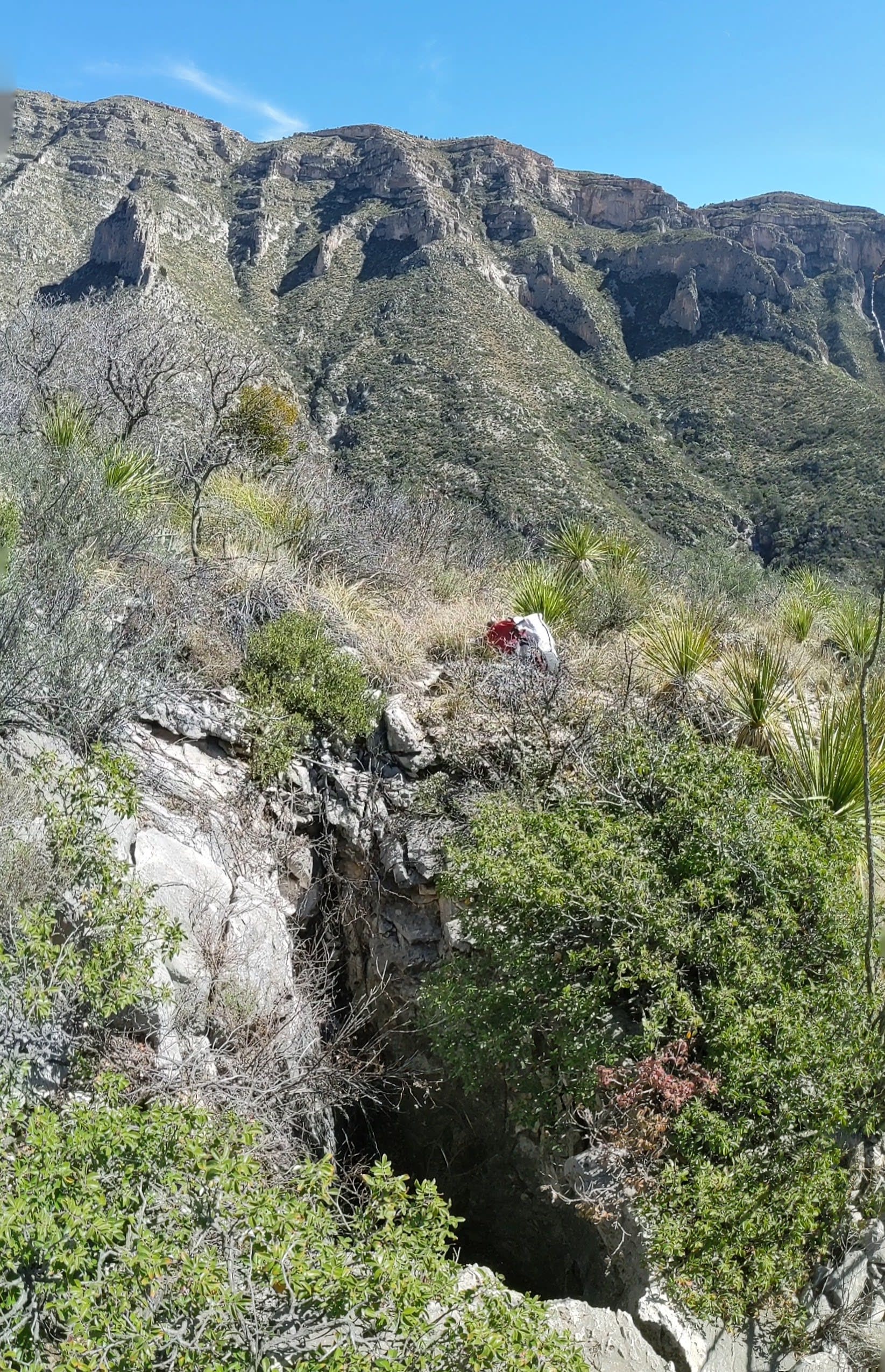
That second LIDAR point did indeed turn out to be a cave. When I got there, I was excited by the clearly cavey entrance, although it seemed to end immediately.
There were neat eroded formations right at the entrance. It seemed like there was nothing more than just the entrance visible above, until I saw a hole between the leaves on the floor and the bedrock wall. The hole was smaller than me but I had a feeling the hole would be larger if I stuffed myself in there and compressed the leaves out of the way. That was indeed true, as the leaves compressed down when I stuck myself in the hole, and I found myself sliding down a small crawlway.
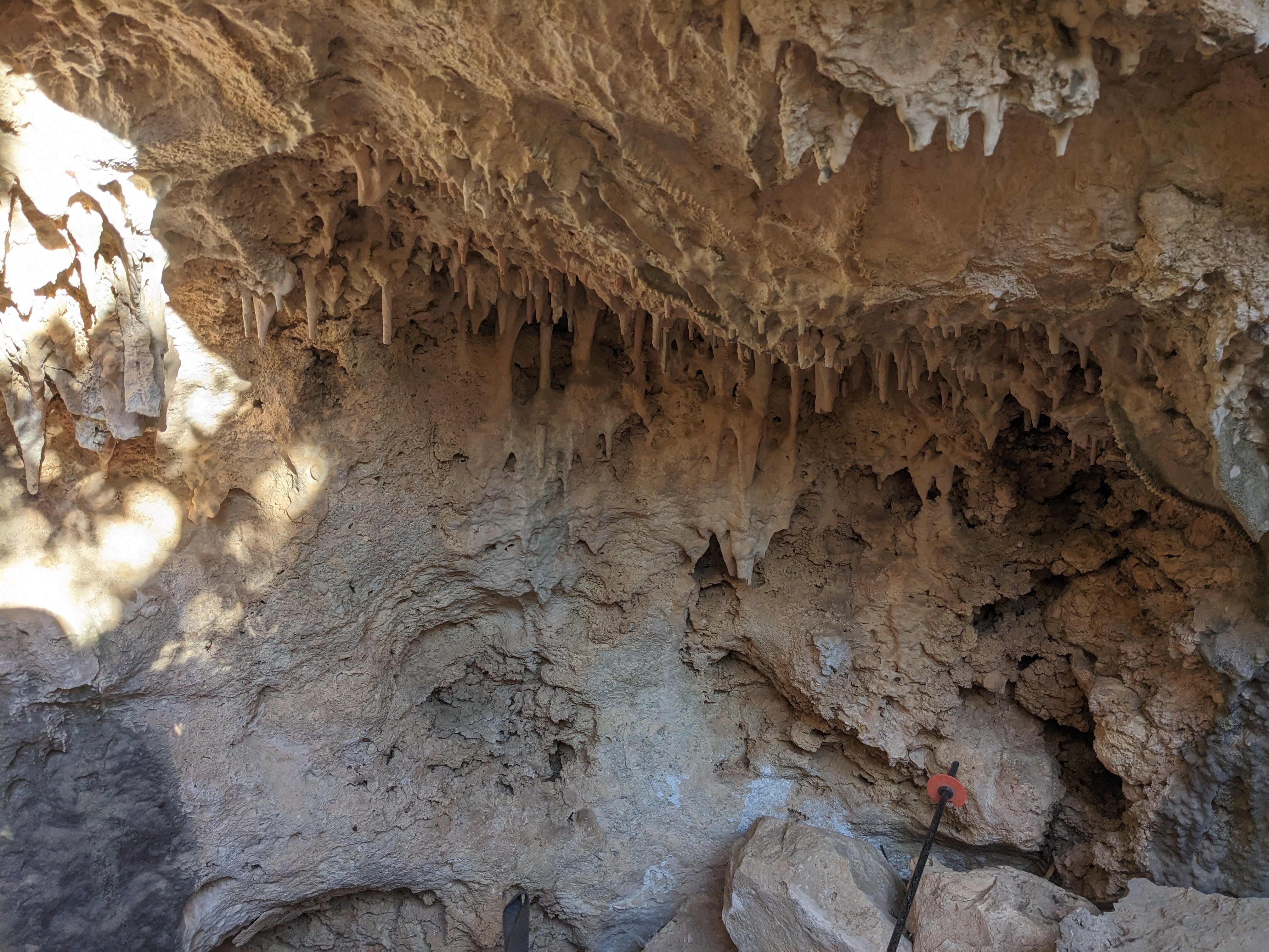
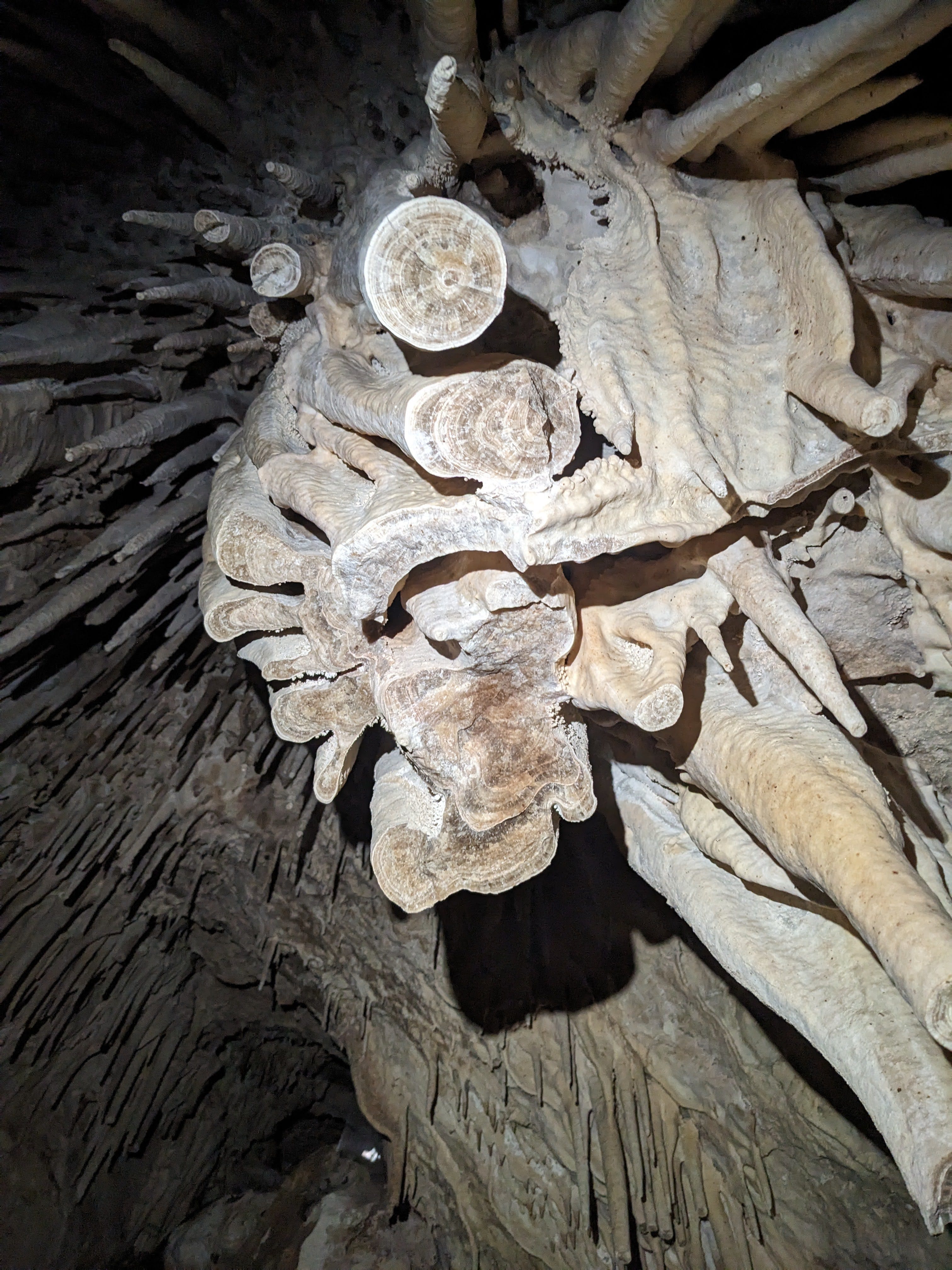
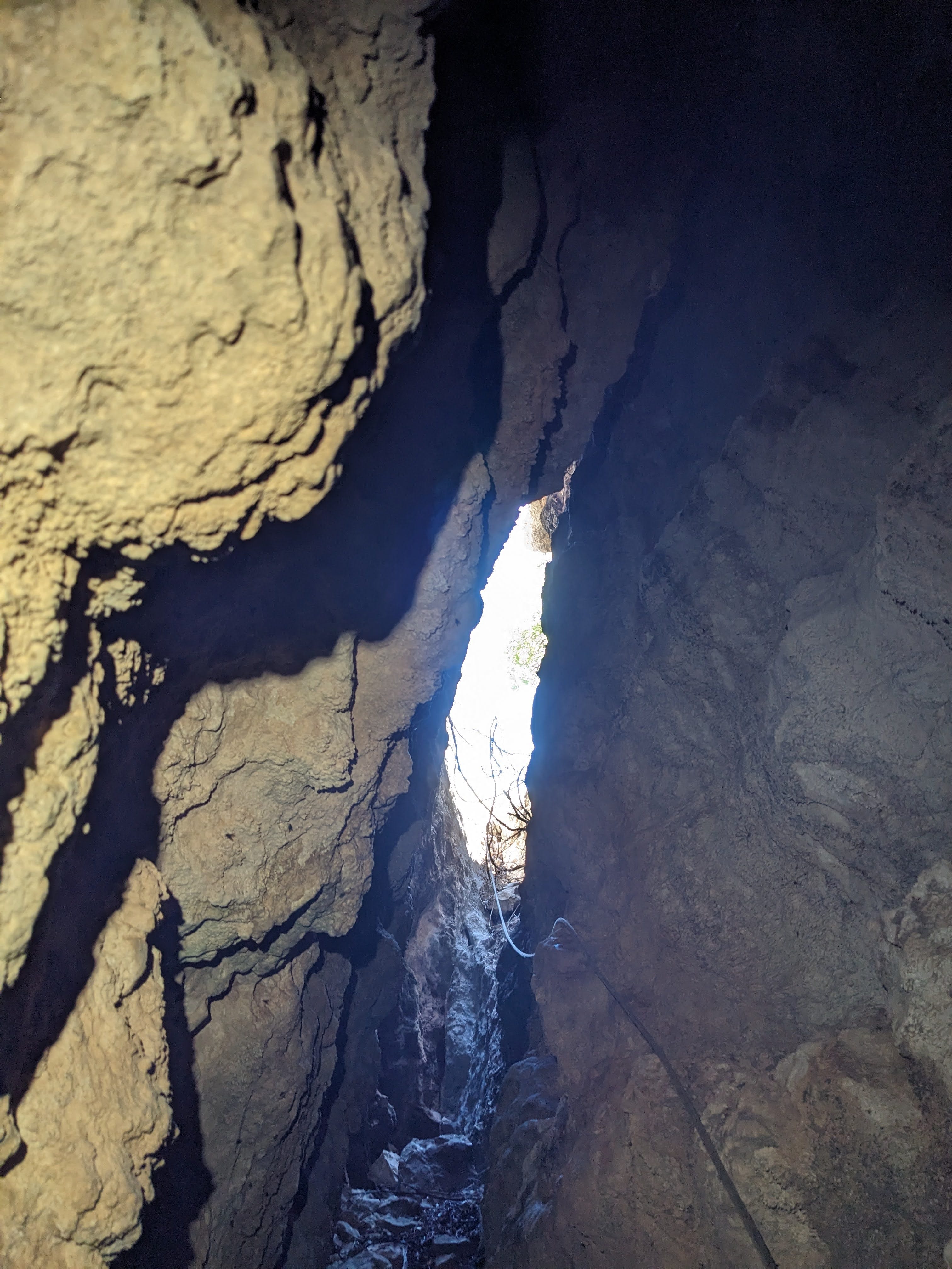
After a few feet of this crawlway, I was surrounded by huge stalactites that I had to carefully navigate to not break as I stepped down onto the floor of a standing room. I was psyched to be standing up surrounded by a hanging garden of stalactites in a walking passage, although just past me it ended. The passage slopes down with a breakdown floor until it meets a vertical wall where it ends. It’s likely a pit that got plugged up with breakdown.
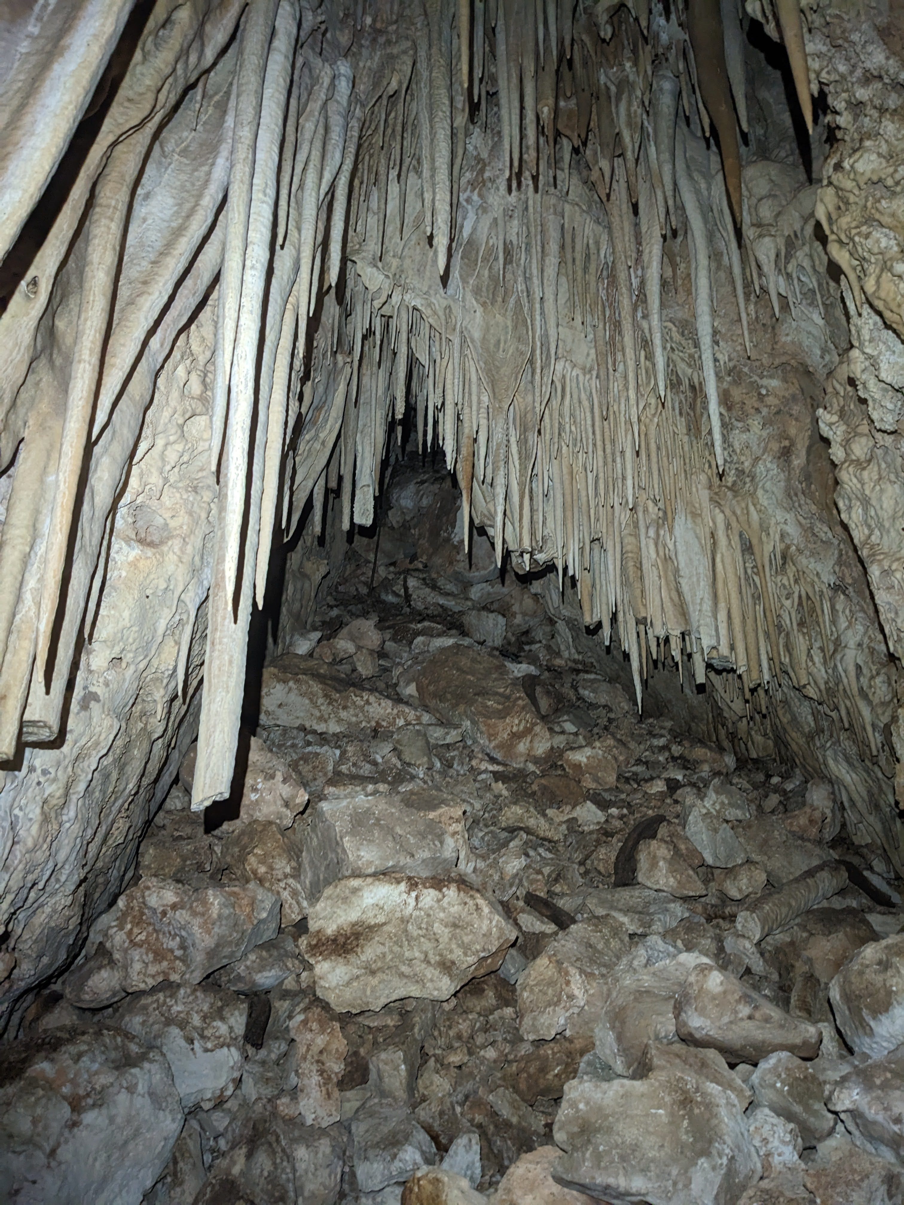
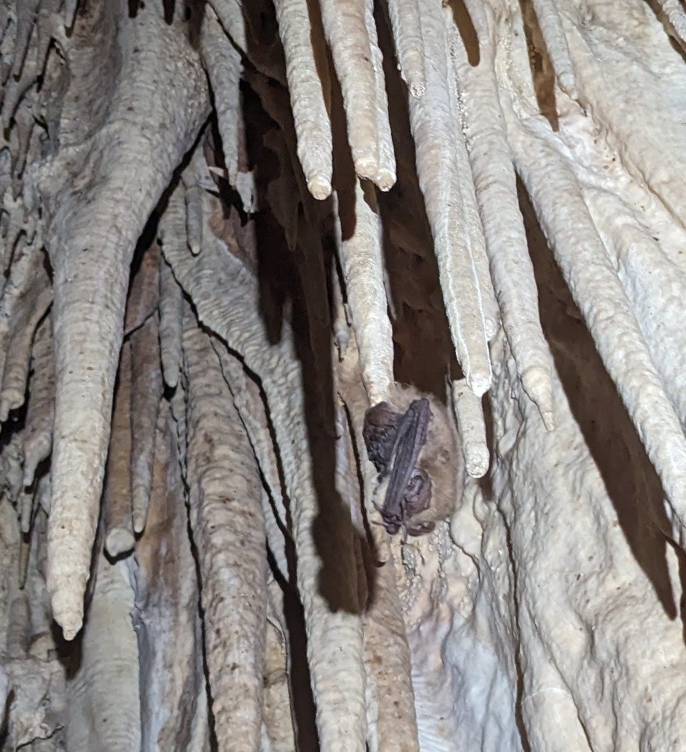
Surprisingly many of the stalactites, even huge ones, were naturally broken. I think it’s from breakdown falling down the slope. Interestingly, there was a bat sleeping while hanging from the very tip of one of the stalactites. I’d never seen that before. For that reason, I named the cave ‘Just the Tip Cave’, after the bat’s sleeping location, and because the accessible portion of the cave is surely just the tip of the larger cave beyond the breakdown plug. The breakdown plug at the bottom has no air and is not a promising dig. There were 2 bats in total.
I surveyed it to 47 ft. After that, I was running low on daylight, so I rushed over to my next LIDAR point, knowing full well that I would be bushwhacking down and finding water in the dark. From Just the Tip Cave, I traversed east to the next sinkhole. This was nothing—just a jumble of rocks in between 2 big fins that made a depression.
From this LIDAR hit, I descended more-or-less straight down the SW-trending gully just to the west of the LIDAR hit. This gully, though brushy, was much more pleasant than the bushwhacking earlier in the day, as it was finally cool enough to wear pants. It was pitch black out by this point.
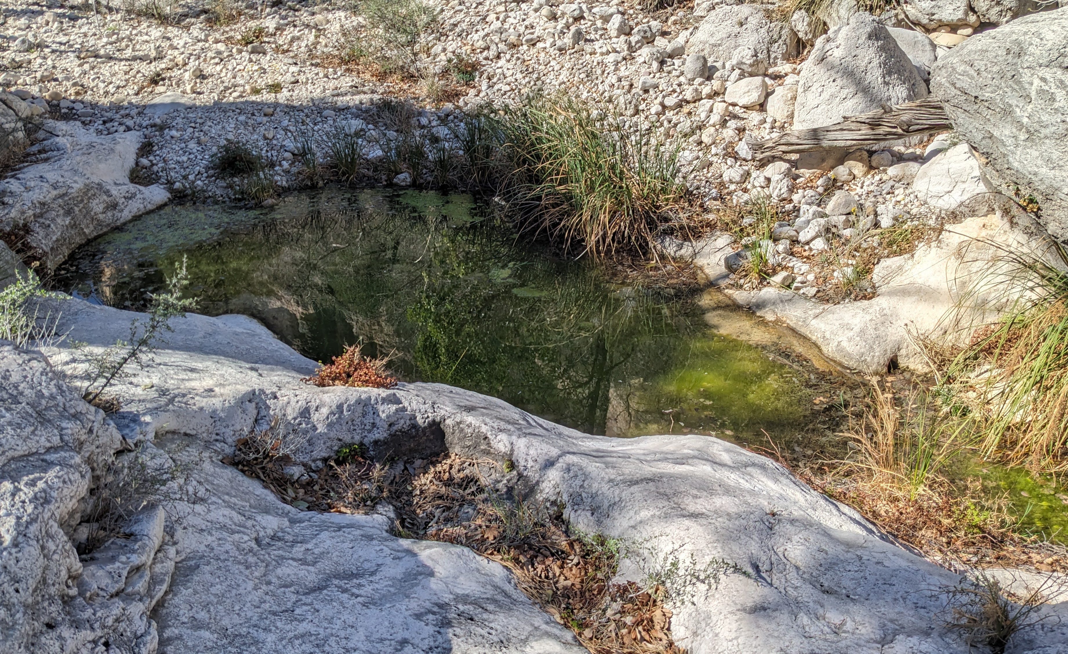
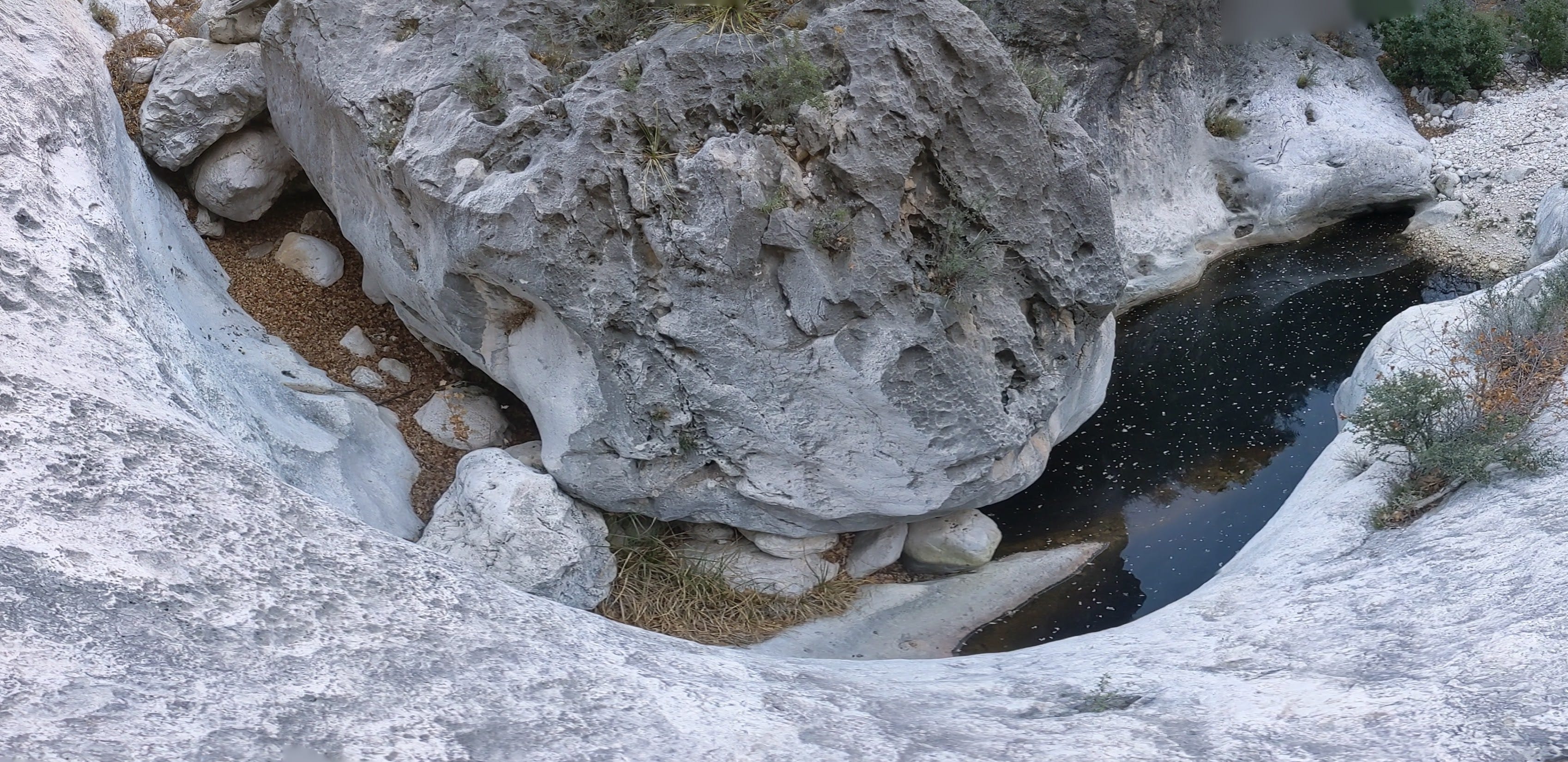
I was relieved once I made it back down into the large arroyo of McKittrick Canyon, as the route I took up out of the arroyo was a little sketchy at the start, and I didn’t want to repeat that. Thankfully, the route I took down was easier. Also, scrambling and bushwhacking around in the Guads always feels a little creepy to me when it’s pitch black out and I’m alone. So getting out of that zone was a nice feeling. Although my day was not over yet, as I still had to find a good water source. I was momentarily scared for a bit in the arroyo when I encountered strange loud animal sounds at a pool. They were super loud, but strangely I couldn’t see anything where the sounds were clearly coming from at the far end of the pool. After a few moments, I determined that these sounds were frogs. I didn’t spot any frogs, but there were many tadpoles in the pools visible. Listen to the video below to hear the sound. They were much louder in real life.
I continued downstream and kept encountering gross stagnant brown pools, which was a little disconcerting. I could drink from them if I really had to (I had treatment chemicals), but I didn’t want to. A dinner of oatmeal with a side of pond scum did not sound appetizing to me. Thankfully, I found one pool that was clean and clear. Serendipitously, it turned out to be the last pool before the water disappeared for a while. After finding this one clear clean pool, I continued down canyon for a bit, hoping to find water that was not only clean and clear but also flowing vigorously. I did not find that, as the water disappeared at the end of this pool and didn’t return in the quarter mile I continued down canyon. After later looking on the satellite maps at home, it appears that water would have come back after another few hundred ft, and likely would have been flowing. No matter; I was satisfied with the water source I had.
I settled for the clean and clear yet stagnant pool and set up camp. I officially stopped hiking and took off my pack for the night at 9:16pm. With my nerves finally calm after getting out of the death-scrambling-in-the-dark zone and finding satisfactory water, I set up camp. I played some Sabrina Carpenter to set the mood1 as I set up my bougie campsite on the pavement beside the pool. I had a luxurious canopy of blooming madrones and clear stars above me. Just to my side was a still clear pool. I imagined I was at a beachside resort on the Mediterranean. Maybe if it was warm enough I would go swimming the next morning.
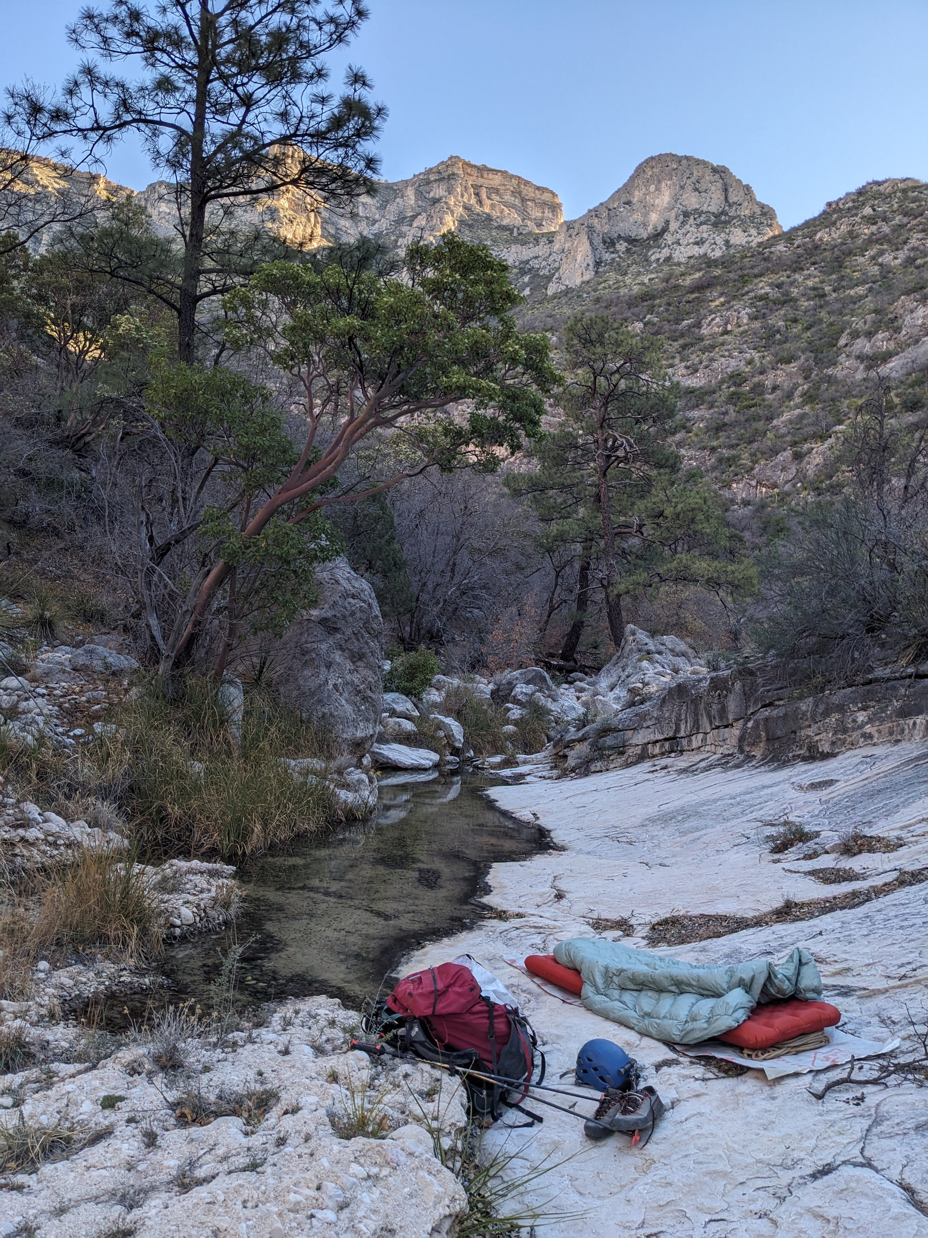
I drank about 3.5 liters of water that day before making it to camp. So my 6 would have been enough to make it back if I had to. I made my dinner of oatmeal without extra pond scum flavor, which I much appreciated. Bringing dried food that can be rehydrated with cold water (and still tastes good cold) is nice on trips like this when it’s hot so I don’t really need hot food, and I’d rather save the weight of a stove. I went to bed just before 10pm, satisfied with a productive day of knocking off LIDAR hits, but slightly disappointed that they all didn’t go.
Sunday, March 22
I woke up at another positively alpine time of 8:30am. Man, the previous day must have really worked me to make me sleep for 10+ hours. I made an oatmeal breakfast identical to last night’s dinner, gathered and treated some water, and packed up camp. It was nice that packing up camp took all of 5 minutes, as I didn’t have a tent.
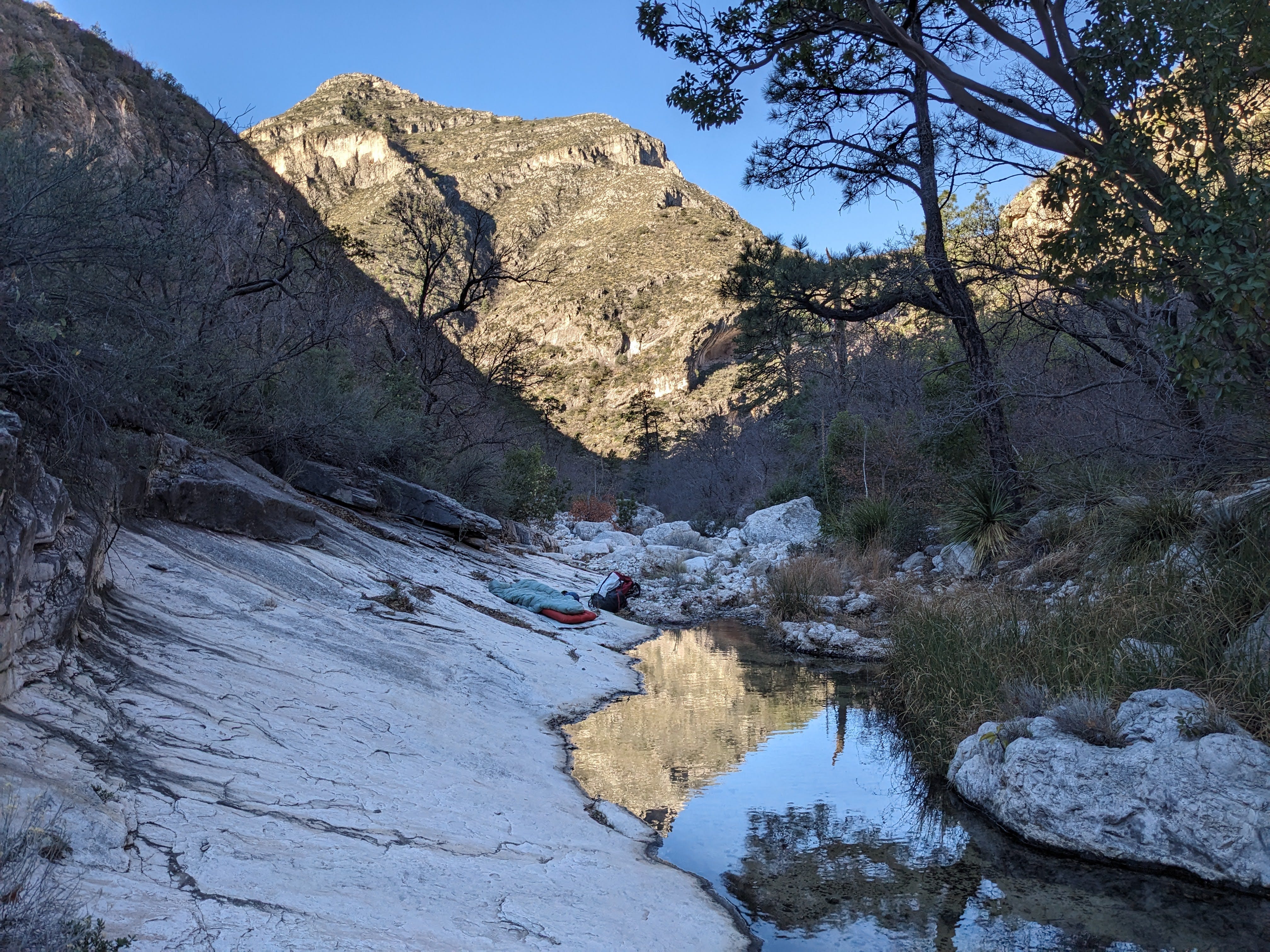
My only objective that day, besides making it back to the car safely, was checking a LIDAR point low down on the ridge separating North McKittrick Canyon from the adjacent Devils Den Canyon to the south. This point was only a little upstream of camp, so I got a brief warmup for my legs before having to charge up yet another evil steep vegetated Guads slope.
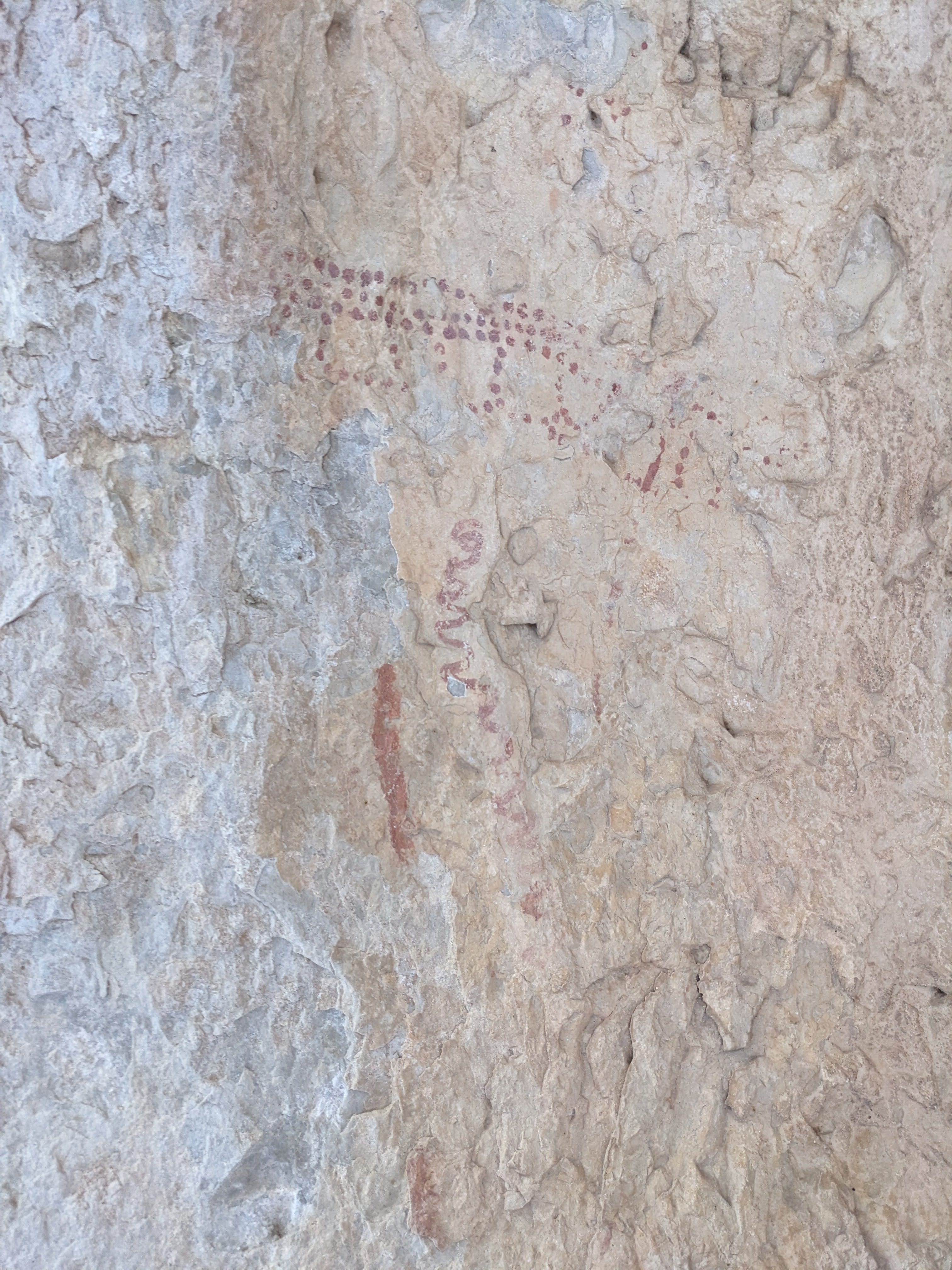
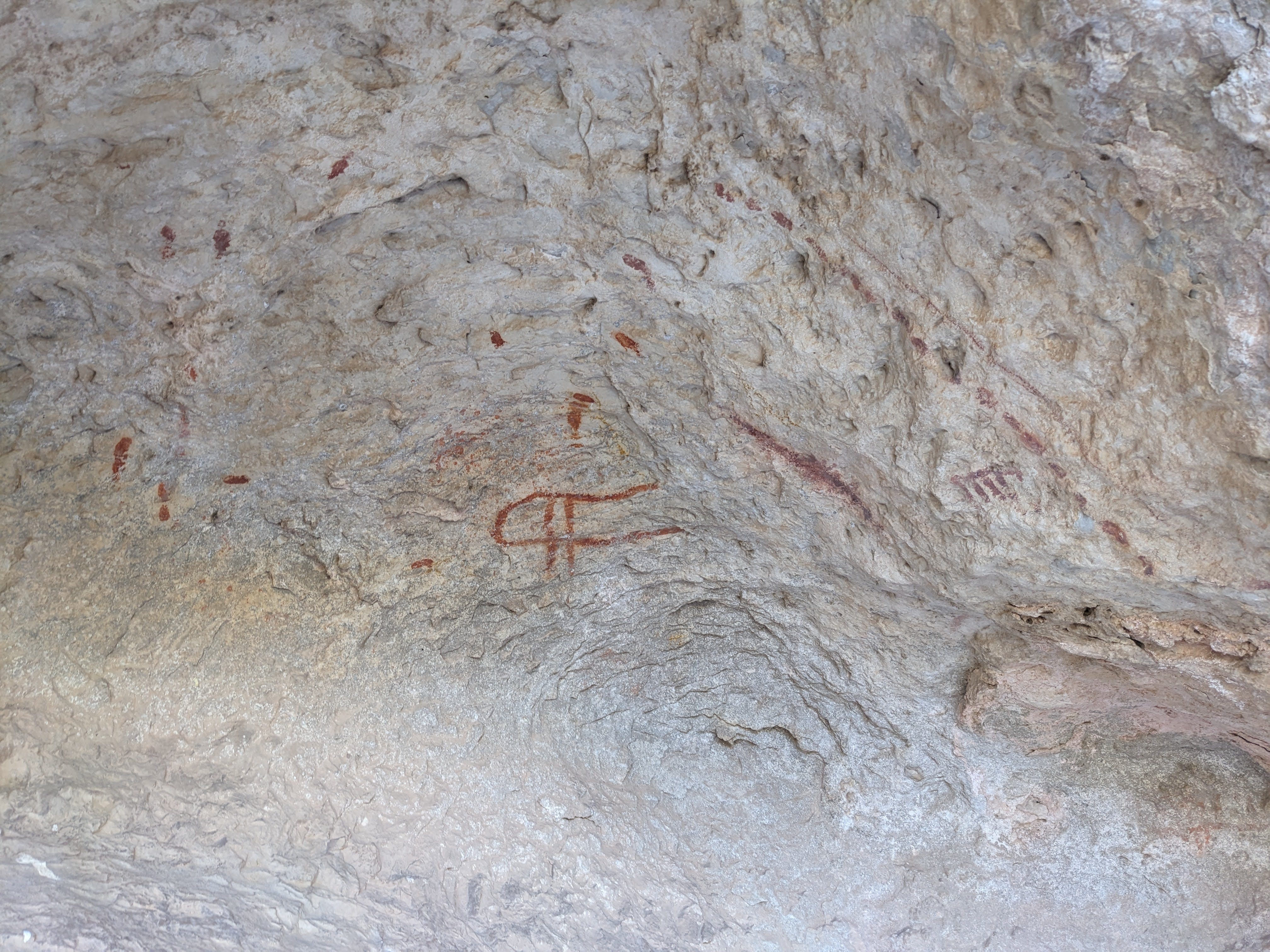
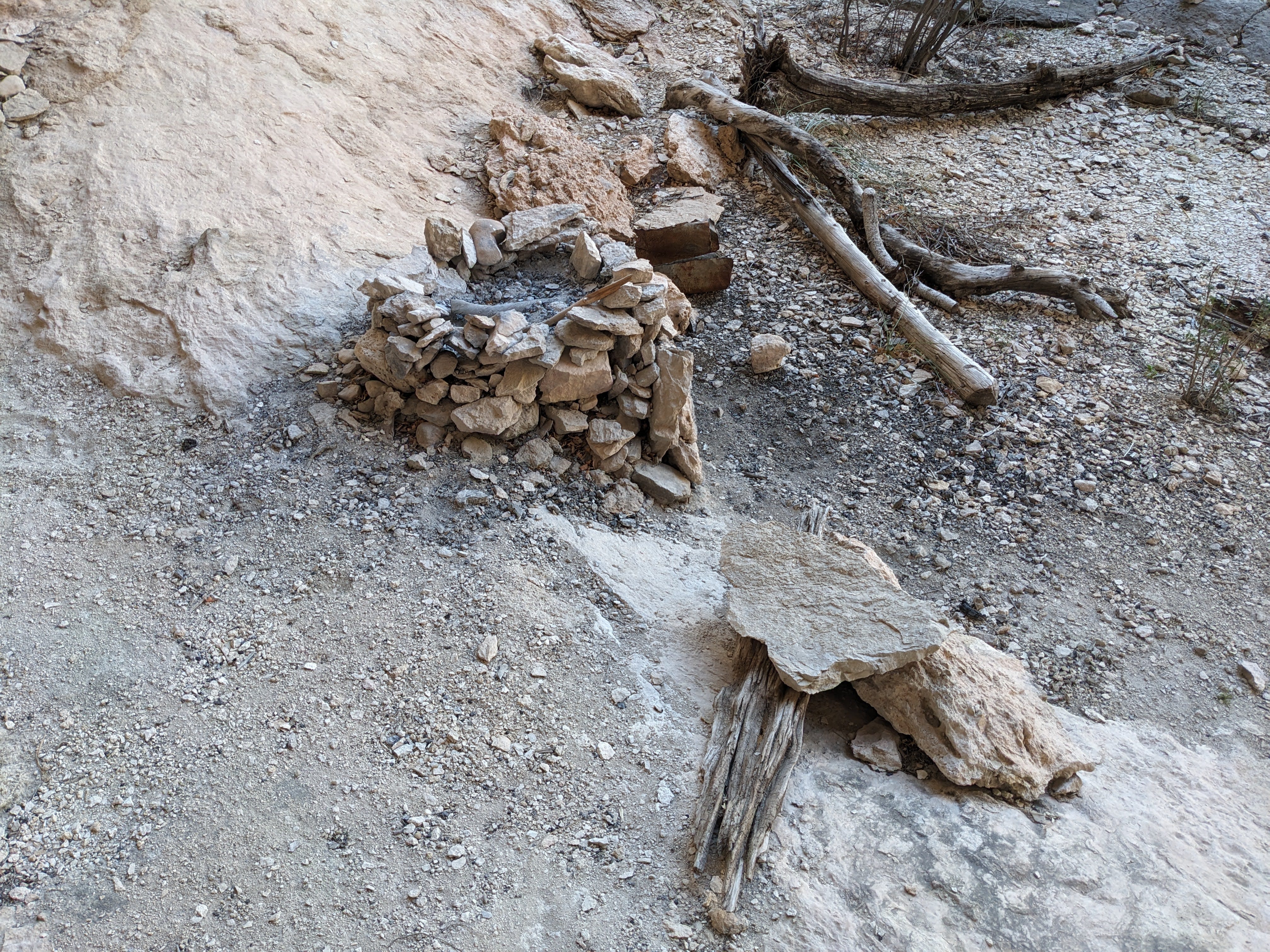
As I walked upstream in the arroyo, back towards the way I came, something caught my eye that I didn’t see the day before in darkness. There was a large shelter overhang right next to the arroyo. These large overhangs near water (that was likely flowing right here in the anthropologically recent past) are prime spots for Native American archeology, so I went up to it to see what I could find. The first thing I saw under the overhang was a large fire ring and some camp furniture, but upon closer inspection of the walls of the shelter overhang I was psyched to find pictographs! I spent some time admiring and photographing them while thinking about what it would be like to live here. I bet this place would seem luxurious in a time before such technological marvels as shingle roofs.
A few minutes past the pictographs, it was time for me to charge up the hill to my south. I was dreading this moment, as it was sunny and hot by this time (10:15am). Also, I would be going up a north(-ish) facing slope, unlike the south-facing slopes I ascended yesterday. North-facing slopes in the Guads are generally worse, vegetation-wise, than south-facing slopes, as the denser and more expansive plants seem to like it more there.
I sucked it up and started up the hill. It was even worse than I expected, as some parts of it were cliffy and scrambly, and I had to pull a few rock climbing moves while crashing into dense Gambel oak that was hell-bent on repelling me. Also, oddly, I kept kicking up fine dry dust from the ground when I disturbed it, and the dust would get in my mouth and give me this horrible bitter taste. A few times I had to stop and gargle some water to get the taste of the dust out of my mouth. I’d never encountered that before.
After 400ft of elevation gain that took about an hour, I arrived at the LIDAR lead of the day. It was another pit! I was a bit beaten down, and short on time if I wanted to get back to Albuquerque at a reasonable time, so I considered leaving the pit for another day. It would be nice to have an excuse to camp at that wonderful campsite again and bring more people there However, I talked myself out of that silly position when I thought about doing that horrific bushwhack up the hill again.
I tied the rope to a good tree right next to the pit and went on down. Alas, it did not go. There was a little bit of passage at the bottom. I surveyed the whole cave to 58ft. There was one bat. I named it ‘The Tannin Pit’, after the strong bitter taste of the dirt/dust I kicked up hiking to the cave.
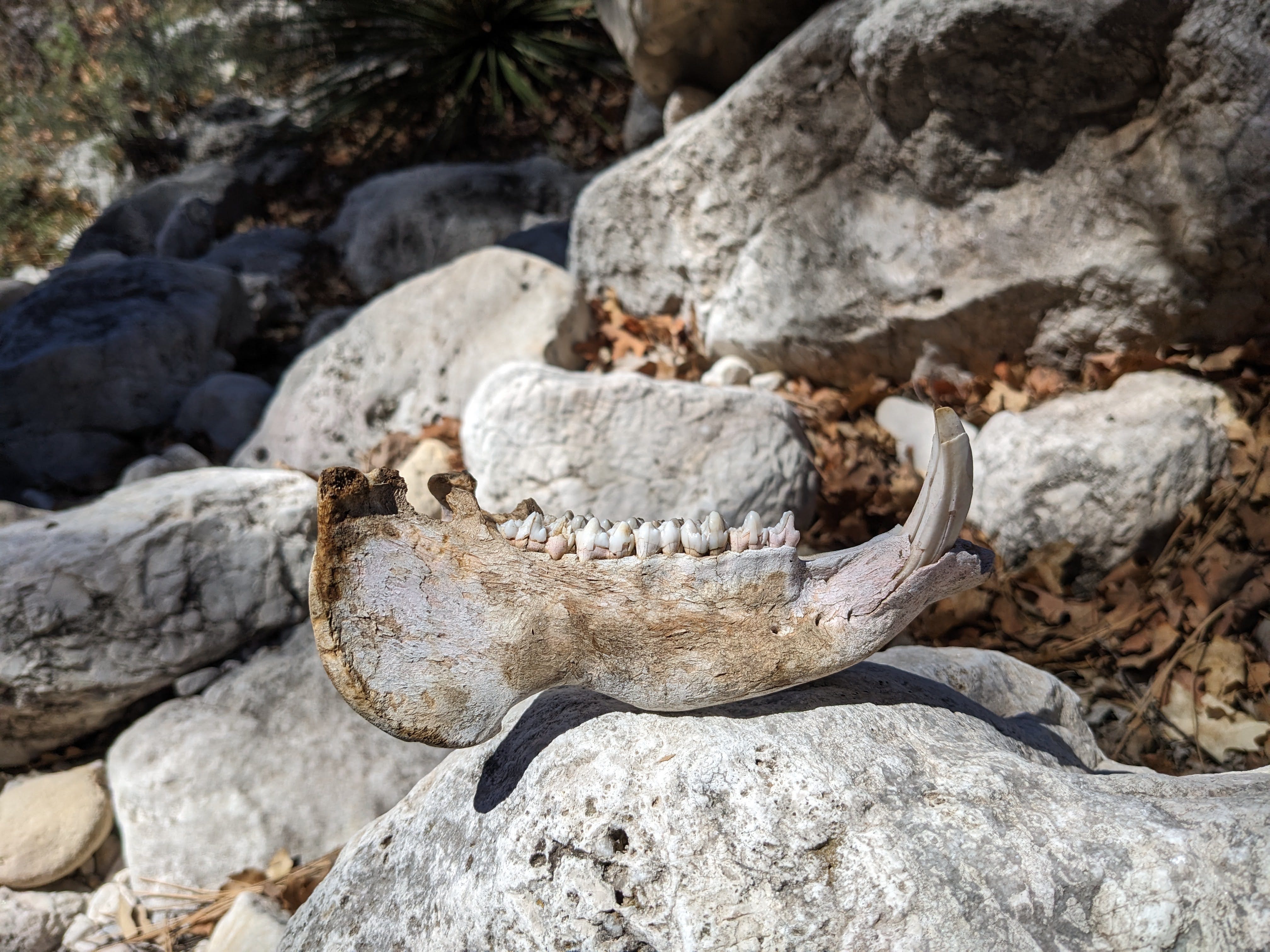
The Tannin pit was my last objective of the trip, so it was time to go home now. I found a slightly better route down the slope to the arroyo (at least, it felt better, possibly because I was going downhill so I could use gravity to assist me in crashing through the bushes). The hike out was mostly uneventful, besides the crushing heat of course. I felt like I had to stop for water every 20 minutes or so. I did find this cool javelina jawbone:
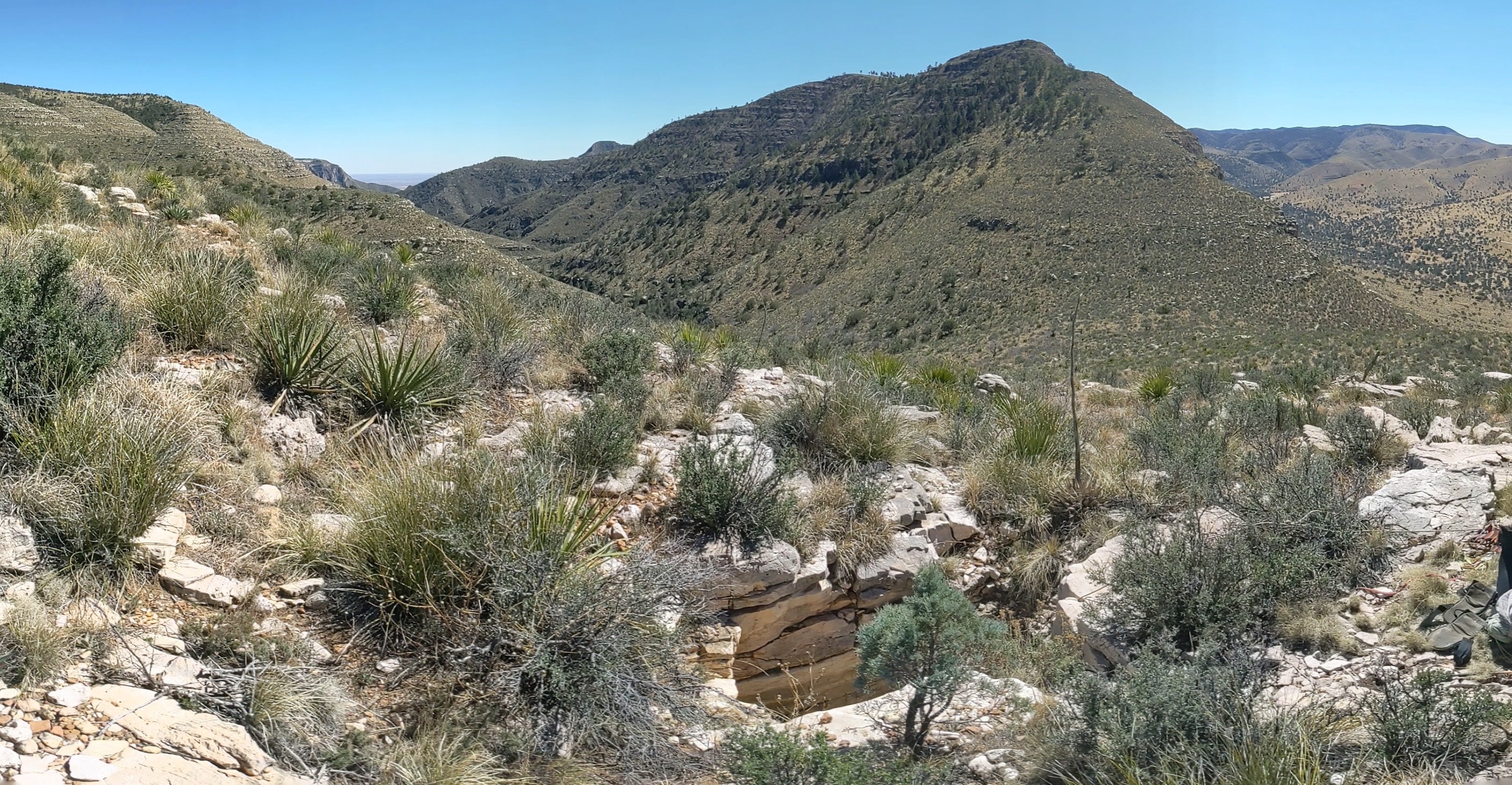
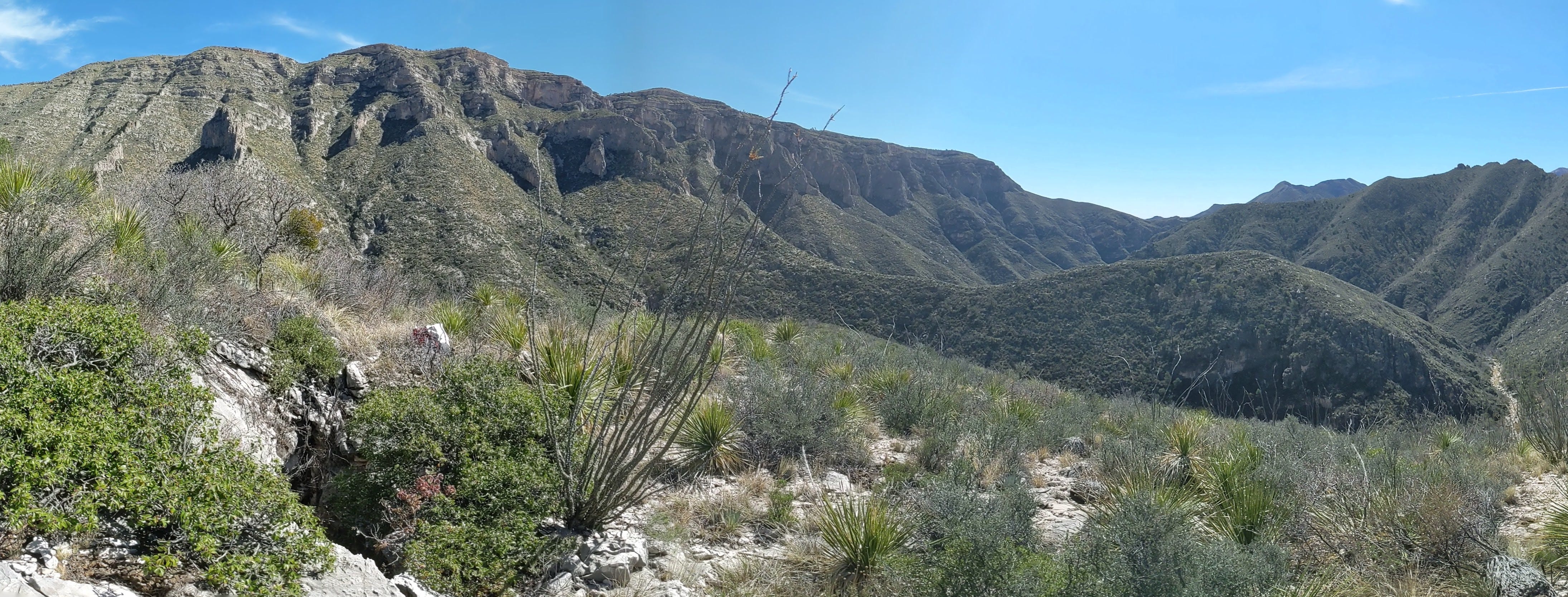
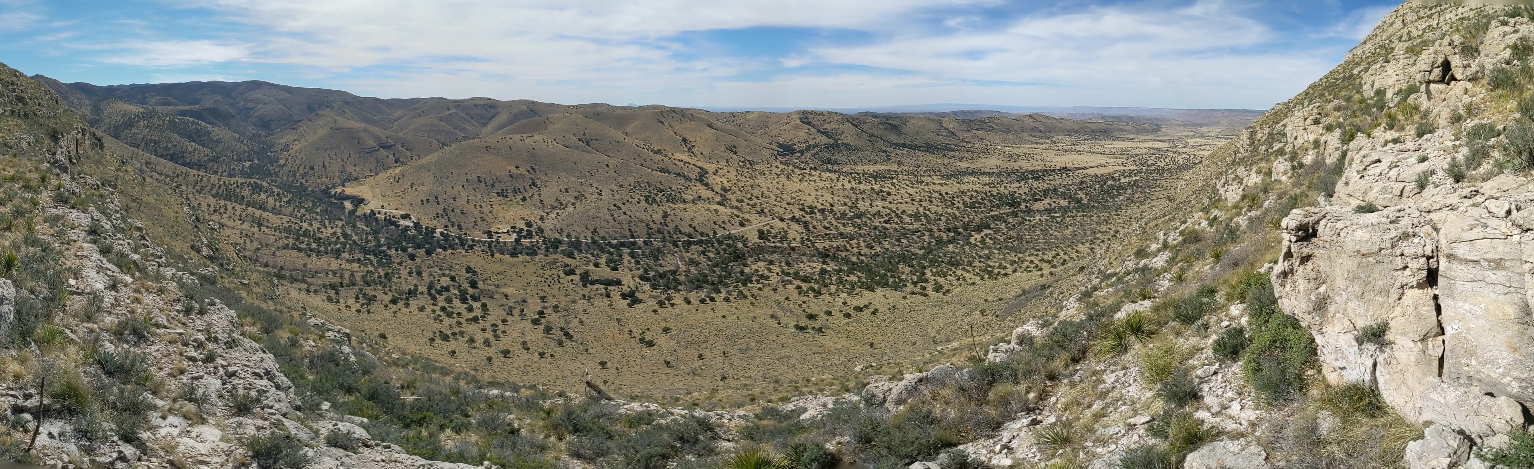
On the way out, because I didn’t have to go by the LIDAR hit now known as Barbary Pit that I checked at the start of my trip, I took a more direct route to the main escarpment dividing the west and east sides of the Guads. I was a little nervous that my more direct route would make me get cliffed out when going back up to, or back down from, the very top of the escarpment, as there were many little cliff bands guarding the escarpment there. However, I had no trouble crossing over the escarpment further south than where I started the trip. My last stressor of the trip was gone when I descended below the lowest cliff band guarding the western slope of the escarpment, at which point I took the following panorama:
I made it back to the car just past 4pm, in time to get to Albuquerque at a reasonable hour before work the next morning. As I drove back, I took a quick swim in Brantley Lake State Park. The water was cold and refreshing. I also got some ice cream in Roswell which was similarly cold and refreshing and hit the spot.
I’ve been really into her music lately. What can I say, I’m a man of simple tastes.
Great report Alex! A few decades ago (~ 1968 perhaps), just before McKittrick Canyon became part of the NPS, we made a trip from Dallas to the entrance of McKittrick Canyon. At that time we were able to drive part way into the canyon to a building. Just beyond was a trail going up the canyon wall to the top. There were several natural bridges and shelters, plus some water pools. No LIDAR then, and we didn’t find any real caves ;-)